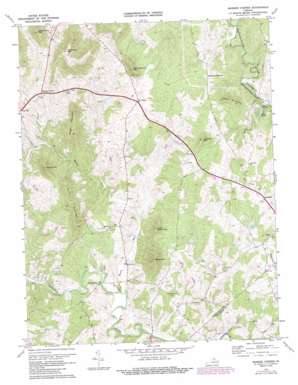
Massies Corner Topo Map Virginia
To zoom in, hover over the map of Massies Corner
USGS Topo Quad 38078f1 - 1:24,000 scale
| Topo Map Name: | Massies Corner |
| USGS Topo Quad ID: | 38078f1 |
| Print Size: | ca. 21 1/4" wide x 27" high |
| Southeast Coordinates: | 38.625° N latitude / 78° W longitude |
| Map Center Coordinates: | 38.6875° N latitude / 78.0625° W longitude |
| U.S. State: | VA |
| Filename: | o38078f1.jpg |
| Download Map JPG Image: | Massies Corner topo map 1:24,000 scale |
| Map Type: | Topographic |
| Topo Series: | 7.5´ |
| Map Scale: | 1:24,000 |
| Source of Map Images: | United States Geological Survey (USGS) |
| Alternate Map Versions: |
Massies Corner VA 1971, updated 1972 Download PDF Buy paper map Massies Corner VA 1971, updated 1983 Download PDF Buy paper map Massies Corner VA 1971, updated 1987 Download PDF Buy paper map Massies Corner VA 1994, updated 1997 Download PDF Buy paper map Massies Corner VA 2010 Download PDF Buy paper map Massies Corner VA 2013 Download PDF Buy paper map Massies Corner VA 2016 Download PDF Buy paper map |
1:24,000 Topo Quads surrounding Massies Corner
> Back to 38078e1 at 1:100,000 scale
> Back to 38078a1 at 1:250,000 scale
> Back to U.S. Topo Maps home
Massies Corner topo map: Gazetteer
Massies Corner: Airports
Thornton River Airport elevation 111m 364′Massies Corner: Crossings
Tapps Ford elevation 115m 377′Massies Corner: Dams
Liverman Dam elevation 132m 433′Mosby Dam elevation 122m 400′
Smiley Dam elevation 126m 413′
Sweeney Dam elevation 144m 472′
Massies Corner: Populated Places
Hackleys Crossroad elevation 159m 521′Korea elevation 158m 518′
Laurel Mills elevation 122m 400′
Massanova elevation 132m 433′
Massies Corner elevation 180m 590′
Viewtown elevation 135m 442′
Massies Corner: Reservoirs
Lake Mosby elevation 122m 400′Lake Wilson elevation 120m 393′
Liverman Pond elevation 132m 433′
Mosby Lake elevation 119m 390′
Sweeney Lake elevation 144m 472′
Massies Corner: Streams
Battle Run elevation 109m 357′Cannons Run elevation 124m 406′
Hawkins Run elevation 97m 318′
Mill Run elevation 109m 357′
Massies Corner: Summits
Aaron Mountain elevation 305m 1000′Battle Mountain elevation 336m 1102′
Googe Mountain elevation 328m 1076′
Hickerson Mountain elevation 416m 1364′
Jefferson Mountain elevation 268m 879′
Little Battle Mountain elevation 271m 889′
Little Mulky Mountain elevation 374m 1227′
Long Mountain elevation 267m 875′
Meetinghouse Mountain elevation 300m 984′
Poes Mountain elevation 252m 826′
Round Mountain elevation 332m 1089′
Massies Corner digital topo map on disk
Buy this Massies Corner topo map showing relief, roads, GPS coordinates and other geographical features, as a high-resolution digital map file on DVD:
Western Virginia & Southern West Virginia
Buy digital topo maps: Western Virginia & Southern West Virginia


