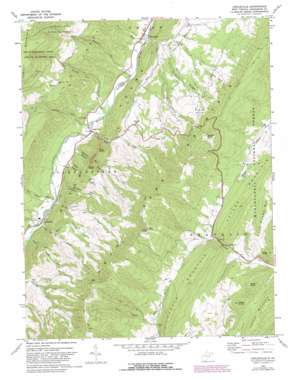
Circleville Topo Map West Virginia
To zoom in, hover over the map of Circleville
USGS Topo Quad 38079f4 - 1:24,000 scale
| Topo Map Name: | Circleville |
| USGS Topo Quad ID: | 38079f4 |
| Print Size: | ca. 21 1/4" wide x 27" high |
| Southeast Coordinates: | 38.625° N latitude / 79.375° W longitude |
| Map Center Coordinates: | 38.6875° N latitude / 79.4375° W longitude |
| U.S. State: | WV |
| Filename: | o38079f4.jpg |
| Download Map JPG Image: | Circleville topo map 1:24,000 scale |
| Map Type: | Topographic |
| Topo Series: | 7.5´ |
| Map Scale: | 1:24,000 |
| Source of Map Images: | United States Geological Survey (USGS) |
| Alternate Map Versions: |
Circleville WV 1968, updated 1973 Download PDF Buy paper map Circleville WV 1968, updated 1982 Download PDF Buy paper map Circleville WV 1995, updated 1998 Download PDF Buy paper map Circleville WV 2011 Download PDF Buy paper map Circleville WV 2014 Download PDF Buy paper map Circleville WV 2016 Download PDF Buy paper map |
| FStopo: | US Forest Service topo Circleville is available: Download FStopo PDF Download FStopo TIF |
1:24,000 Topo Quads surrounding Circleville
> Back to 38079e1 at 1:100,000 scale
> Back to 38078a1 at 1:250,000 scale
> Back to U.S. Topo Maps home
Circleville topo map: Gazetteer
Circleville: Gaps
False Gap elevation 757m 2483′Judy Gap elevation 621m 2037′
Lambert Gap elevation 724m 2375′
Nelson Gap elevation 677m 2221′
Riverton Gap elevation 566m 1856′
Circleville: Populated Places
Circleville elevation 627m 2057′Riverton elevation 542m 1778′
Simoda elevation 909m 2982′
Circleville: Ridges
Dolly Ridge elevation 750m 2460′River Knobs elevation 748m 2454′
Circleville: Springs
Roaring Springs elevation 621m 2037′Wilkins Spring elevation 675m 2214′
Circleville: Streams
Blizzard Run elevation 558m 1830′Bouses Run elevation 628m 2060′
Briery Gap Run elevation 569m 1866′
Dice Run elevation 541m 1774′
Harper Run elevation 615m 2017′
Judy Run elevation 583m 1912′
Kile Run elevation 607m 1991′
Laurel Run elevation 578m 1896′
Morgan Run elevation 614m 2014′
Nelson Run elevation 589m 1932′
Pike Gap Run elevation 623m 2043′
Red Lick Run elevation 614m 2014′
Root Run elevation 545m 1788′
Stringtown Run elevation 559m 1833′
Twin Run elevation 753m 2470′
Circleville: Summits
Bible Knob elevation 923m 3028′Bland Hills elevation 878m 2880′
Castle Mountain elevation 1032m 3385′
Cedar Knob elevation 891m 2923′
Harmon Rocks elevation 1243m 4078′
Judy Rocks elevation 938m 3077′
Moser Knob elevation 942m 3090′
Nelson Rocks elevation 912m 2992′
Peters Mountain elevation 994m 3261′
Pike Knob elevation 1308m 4291′
Pond Range Mountain elevation 951m 3120′
Circleville: Valleys
Lynn Lick Hollow elevation 664m 2178′Noah Teter Hollow elevation 633m 2076′
Circleville digital topo map on disk
Buy this Circleville topo map showing relief, roads, GPS coordinates and other geographical features, as a high-resolution digital map file on DVD:
Western Virginia & Southern West Virginia
Buy digital topo maps: Western Virginia & Southern West Virginia


