Beverly East Topo Map West Virginia
To zoom in, hover over the map of Beverly East
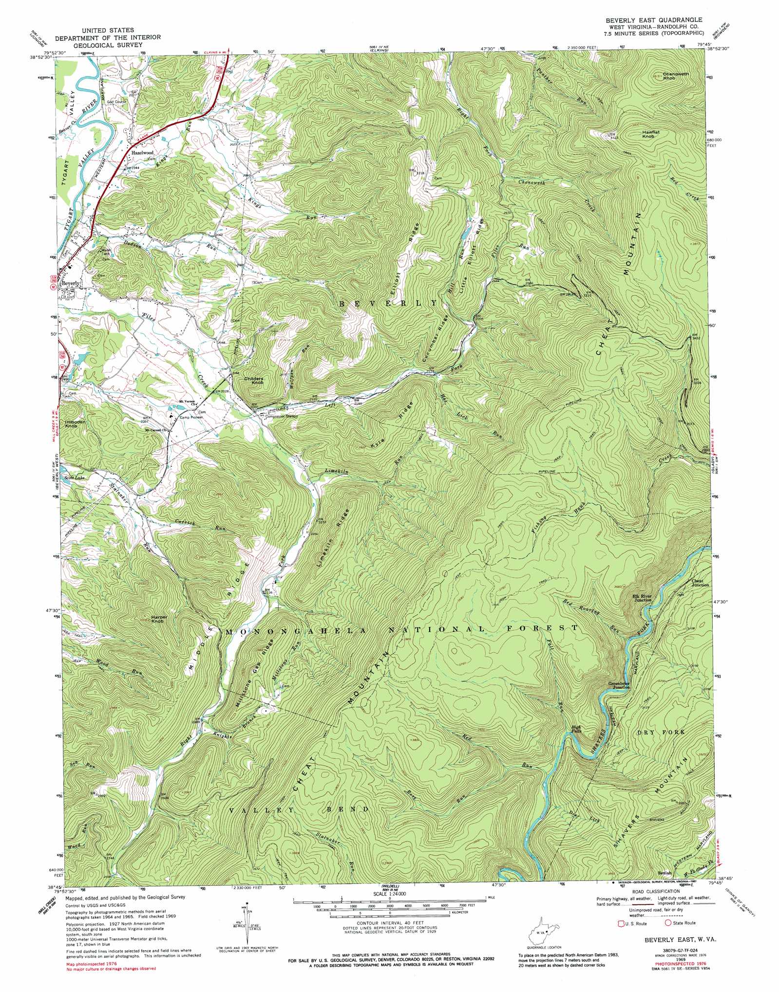
USGS Topo Quad 38079g7 - 1:24,000 scale
| Topo Map Name: | Beverly East |
| USGS Topo Quad ID: | 38079g7 |
| Print Size: | ca. 21 1/4" wide x 27" high |
| Southeast Coordinates: | 38.75° N latitude / 79.75° W longitude |
| Map Center Coordinates: | 38.8125° N latitude / 79.8125° W longitude |
| U.S. State: | WV |
| Filename: | o38079g7.jpg |
| Download Map JPG Image: | Beverly East topo map 1:24,000 scale |
| Map Type: | Topographic |
| Topo Series: | 7.5´ |
| Map Scale: | 1:24,000 |
| Source of Map Images: | United States Geological Survey (USGS) |
| Alternate Map Versions: |
Beverly East WV 1969, updated 1971 Download PDF Buy paper map Beverly East WV 1969, updated 1977 Download PDF Buy paper map Beverly East WV 1969, updated 1987 Download PDF Buy paper map Beverly East WV 1995, updated 1998 Download PDF Buy paper map Beverly East WV 2011 Download PDF Buy paper map Beverly East WV 2014 Download PDF Buy paper map Beverly East WV 2016 Download PDF Buy paper map |
| FStopo: | US Forest Service topo Beverly East is available: Download FStopo PDF Download FStopo TIF |
1:24,000 Topo Quads surrounding Beverly East
Audra |
Belington |
Montrose |
Parsons |
Mozark Mountain |
Ellamore |
Junior |
Elkins |
Bowden |
Harman |
Cassity |
Beverly West |
Beverly East |
Glady |
Whitmer |
Adolph |
Mill Creek |
Wildell |
Sinks Of Gandy |
Spruce Knob |
Valley Head |
Snyder Knob |
Durbin |
Thornwood |
Snowy Mountain |
> Back to 38079e1 at 1:100,000 scale
> Back to 38078a1 at 1:250,000 scale
> Back to U.S. Topo Maps home
Beverly East topo map: Gazetteer
Beverly East: Dams
Scott Lake Dam elevation 603m 1978′Sherwan Lake Dam elevation 595m 1952′
Beverly East: Falls
High Falls elevation 878m 2880′Beverly East: Populated Places
Beulah elevation 935m 3067′Cheat Junction elevation 858m 2814′
Elk River Junction elevation 836m 2742′
Greenbrier Junction elevation 880m 2887′
Hazelwood elevation 608m 1994′
Beverly East: Ridges
Cucumber Ridge elevation 848m 2782′Elliott Ridge elevation 989m 3244′
Kyle Ridge elevation 878m 2880′
Limekiln Ridge elevation 877m 2877′
Little Elliott Ridge elevation 871m 2857′
Middle Ridge elevation 826m 2709′
Millstone Gap Ridge elevation 885m 2903′
Beverly East: Streams
Beaver Creek elevation 586m 1922′Carrick Run elevation 630m 2066′
Deer Lick elevation 902m 2959′
Dodson Run elevation 589m 1932′
Fall Run elevation 882m 2893′
Files Run elevation 726m 2381′
Hill Run elevation 726m 2381′
Hoe Lick Run elevation 700m 2296′
Kings Run elevation 588m 1929′
Knights Branch elevation 728m 2388′
Left Fork Files Creek elevation 625m 2050′
Limekiln Run elevation 647m 2122′
Millstone Run elevation 680m 2230′
Panther Run elevation 702m 2303′
Red Roaring Run elevation 838m 2749′
Red Run elevation 891m 2923′
Right Fork Files Creek elevation 625m 2050′
Rose Run elevation 929m 3047′
Wolfpen Run elevation 635m 2083′
Beverly East: Summits
Chenoweth Knob elevation 1169m 3835′Childers Knob elevation 778m 2552′
Harper Knob elevation 913m 2995′
Hawflat Knob elevation 1200m 3937′
Imboden Knob elevation 682m 2237′
Beverly East digital topo map on disk
Buy this Beverly East topo map showing relief, roads, GPS coordinates and other geographical features, as a high-resolution digital map file on DVD:
Western Virginia & Southern West Virginia
Buy digital topo maps: Western Virginia & Southern West Virginia