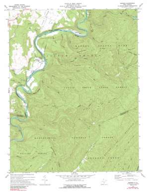
Denmar Topo Map West Virginia
To zoom in, hover over the map of Denmar
USGS Topo Quad 38080a2 - 1:24,000 scale
| Topo Map Name: | Denmar |
| USGS Topo Quad ID: | 38080a2 |
| Print Size: | ca. 21 1/4" wide x 27" high |
| Southeast Coordinates: | 38° N latitude / 80.125° W longitude |
| Map Center Coordinates: | 38.0625° N latitude / 80.1875° W longitude |
| U.S. State: | WV |
| Filename: | o38080a2.jpg |
| Download Map JPG Image: | Denmar topo map 1:24,000 scale |
| Map Type: | Topographic |
| Topo Series: | 7.5´ |
| Map Scale: | 1:24,000 |
| Source of Map Images: | United States Geological Survey (USGS) |
| Alternate Map Versions: |
Denmar WV 1977, updated 1978 Download PDF Buy paper map Denmar WV 1977, updated 1991 Download PDF Buy paper map Denmar WV 1995, updated 1998 Download PDF Buy paper map Denmar WV 2011 Download PDF Buy paper map Denmar WV 2014 Download PDF Buy paper map Denmar WV 2016 Download PDF Buy paper map |
| FStopo: | US Forest Service topo Denmar is available: Download FStopo PDF Download FStopo TIF |
1:24,000 Topo Quads surrounding Denmar
> Back to 38080a1 at 1:100,000 scale
> Back to 38080a1 at 1:250,000 scale
> Back to U.S. Topo Maps home
Denmar topo map: Gazetteer
Denmar: Forests
Calvin Price State Forest elevation 808m 2650′Denmar: Parks
Watoga State Park elevation 866m 2841′Denmar: Populated Places
Beard elevation 612m 2007′Burnsides elevation 614m 2014′
Denmar elevation 637m 2089′
Kennison elevation 620m 2034′
Locust elevation 608m 1994′
Mill Run (historical) elevation 615m 2017′
Denmar: Ridges
Beaver Lick Mountain elevation 1071m 3513′Burnside Ridge elevation 937m 3074′
Pond Ridge elevation 903m 2962′
Spice Ridge elevation 976m 3202′
Denmar: Springs
Jackson Farm Spring elevation 679m 2227′Denmar: Streams
Davy Run elevation 594m 1948′Hatten Run elevation 614m 2014′
Island Lick Run elevation 622m 2040′
Kennison Run elevation 755m 2477′
Laurel Run elevation 609m 1998′
Locust Creek elevation 603m 1978′
Long Day Run elevation 675m 2214′
Mill Run elevation 614m 2014′
Mill Run elevation 615m 2017′
Nigh Gap Run elevation 614m 2014′
Oldham Run elevation 606m 1988′
Perry Run elevation 644m 2112′
Rock Run elevation 617m 2024′
Spice Run elevation 599m 1965′
Trump Run elevation 605m 1984′
Denmar: Summits
Pyle Mountain elevation 971m 3185′Slabcamp Mountain elevation 1000m 3280′
Denmar: Trails
Arrowhead Trail elevation 767m 2516′Bear Pen Run Trail elevation 817m 2680′
Buck and Doe Trail elevation 939m 3080′
Spice Ridge Trail elevation 895m 2936′
Denmar: Valleys
Crowser Hollow elevation 635m 2083′Denmar digital topo map on disk
Buy this Denmar topo map showing relief, roads, GPS coordinates and other geographical features, as a high-resolution digital map file on DVD:
Western Virginia & Southern West Virginia
Buy digital topo maps: Western Virginia & Southern West Virginia


