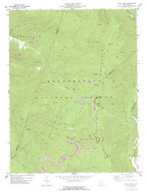
Sharp Knob Topo Map West Virginia
To zoom in, hover over the map of Sharp Knob
USGS Topo Quad 38080d2 - 1:24,000 scale
| Topo Map Name: | Sharp Knob |
| USGS Topo Quad ID: | 38080d2 |
| Print Size: | ca. 21 1/4" wide x 27" high |
| Southeast Coordinates: | 38.375° N latitude / 80.125° W longitude |
| Map Center Coordinates: | 38.4375° N latitude / 80.1875° W longitude |
| U.S. State: | WV |
| Filename: | o38080d2.jpg |
| Download Map JPG Image: | Sharp Knob topo map 1:24,000 scale |
| Map Type: | Topographic |
| Topo Series: | 7.5´ |
| Map Scale: | 1:24,000 |
| Source of Map Images: | United States Geological Survey (USGS) |
| Alternate Map Versions: |
Sharp Knob WV 1977, updated 1978 Download PDF Buy paper map Sharp Knob WV 1995, updated 1998 Download PDF Buy paper map Sharp Knob WV 2011 Download PDF Buy paper map Sharp Knob WV 2014 Download PDF Buy paper map Sharp Knob WV 2016 Download PDF Buy paper map |
| FStopo: | US Forest Service topo Sharp Knob is available: Download FStopo PDF Download FStopo TIF |
1:24,000 Topo Quads surrounding Sharp Knob
> Back to 38080a1 at 1:100,000 scale
> Back to 38080a1 at 1:250,000 scale
> Back to U.S. Topo Maps home
Sharp Knob topo map: Gazetteer
Sharp Knob: Parks
Tea Creek Wildlife Management Area elevation 897m 2942′Sharp Knob: Populated Places
Brush Camp Low Place elevation 1174m 3851′Slaty Fork elevation 818m 2683′
Sharp Knob: Ridges
Cub Ridge elevation 1185m 3887′Flat Ridge elevation 1270m 4166′
Gauley Mountain elevation 1313m 4307′
Middle Mountain elevation 1199m 3933′
Slabcamp Ridge elevation 1212m 3976′
Turkey Mountain elevation 1229m 4032′
Sharp Knob: Streams
Big Run elevation 787m 2582′Big Run elevation 827m 2713′
Big Spring Fork elevation 813m 2667′
Laurel Run elevation 812m 2664′
Middle Fork Gauley River elevation 887m 2910′
North Fork Gauley River elevation 875m 2870′
Old Field Fork elevation 813m 2667′
Panther Run elevation 987m 3238′
Props Run elevation 807m 2647′
Rough Gap Run elevation 742m 2434′
South Fork Gauley River elevation 875m 2870′
Sharp Knob: Summits
Bradshaw Hill elevation 1335m 4379′Buck Knob elevation 1315m 4314′
Rocky Point elevation 1314m 4311′
Sharp Knob elevation 1380m 4527′
South Fork Mountain elevation 1245m 4084′
Sharp Knob digital topo map on disk
Buy this Sharp Knob topo map showing relief, roads, GPS coordinates and other geographical features, as a high-resolution digital map file on DVD:
Western Virginia & Southern West Virginia
Buy digital topo maps: Western Virginia & Southern West Virginia


