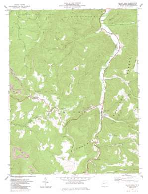
Valley Head Topo Map West Virginia
To zoom in, hover over the map of Valley Head
USGS Topo Quad 38080e1 - 1:24,000 scale
| Topo Map Name: | Valley Head |
| USGS Topo Quad ID: | 38080e1 |
| Print Size: | ca. 21 1/4" wide x 27" high |
| Southeast Coordinates: | 38.5° N latitude / 80° W longitude |
| Map Center Coordinates: | 38.5625° N latitude / 80.0625° W longitude |
| U.S. State: | WV |
| Filename: | o38080e1.jpg |
| Download Map JPG Image: | Valley Head topo map 1:24,000 scale |
| Map Type: | Topographic |
| Topo Series: | 7.5´ |
| Map Scale: | 1:24,000 |
| Source of Map Images: | United States Geological Survey (USGS) |
| Alternate Map Versions: |
Valley Head WV 1977, updated 1977 Download PDF Buy paper map Valley Head WV 1977, updated 1985 Download PDF Buy paper map Valley Head WV 1995, updated 1998 Download PDF Buy paper map Valley Head WV 2011 Download PDF Buy paper map Valley Head WV 2014 Download PDF Buy paper map Valley Head WV 2016 Download PDF Buy paper map |
| FStopo: | US Forest Service topo Valley Head is available: Download FStopo PDF Download FStopo TIF |
1:24,000 Topo Quads surrounding Valley Head
> Back to 38080e1 at 1:100,000 scale
> Back to 38080a1 at 1:250,000 scale
> Back to U.S. Topo Maps home
Valley Head topo map: Gazetteer
Valley Head: Populated Places
Blue Spring elevation 789m 2588′Brady Gate elevation 879m 2883′
Monterville elevation 997m 3270′
Spangler elevation 666m 2185′
Valley Head elevation 723m 2372′
Valley Head: Post Offices
Monterville Post Office elevation 984m 3228′Valley Head Post Office elevation 727m 2385′
Valley Head: Ridges
Dry Ridge elevation 944m 3097′Swecker Ridge elevation 1024m 3359′
Ware Ridge elevation 995m 3264′
Valley Head: Springs
Blue Spring elevation 871m 2857′Ezra Bennett Spring elevation 870m 2854′
Valley Head: Streams
Big Run elevation 789m 2588′Clay Run elevation 654m 2145′
Conley Run elevation 690m 2263′
Elkwater Fork elevation 658m 2158′
Fish Hole Run elevation 759m 2490′
Fortlick Run elevation 728m 2388′
Hamilton Run elevation 682m 2237′
Limekiln Run elevation 701m 2299′
Logan Run elevation 754m 2473′
Mowry Run elevation 689m 2260′
Mudlick Run elevation 788m 2585′
Oxley Run elevation 1003m 3290′
Ralston Run elevation 714m 2342′
Snake Run elevation 802m 2631′
Stewart Run elevation 661m 2168′
Stony Run elevation 749m 2457′
Wamsley Run elevation 653m 2142′
Windy Run elevation 721m 2365′
Valley Head: Summits
Elk Mountain elevation 1336m 4383′Rich Knob elevation 1150m 3772′
Valley Head digital topo map on disk
Buy this Valley Head topo map showing relief, roads, GPS coordinates and other geographical features, as a high-resolution digital map file on DVD:
Western Virginia & Southern West Virginia
Buy digital topo maps: Western Virginia & Southern West Virginia


