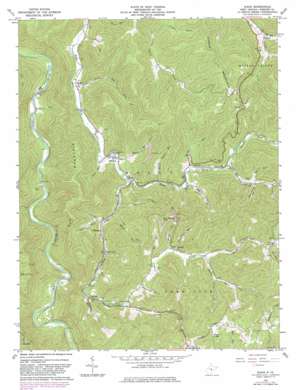
Diana Topo Map West Virginia
To zoom in, hover over the map of Diana
USGS Topo Quad 38080e4 - 1:24,000 scale
| Topo Map Name: | Diana |
| USGS Topo Quad ID: | 38080e4 |
| Print Size: | ca. 21 1/4" wide x 27" high |
| Southeast Coordinates: | 38.5° N latitude / 80.375° W longitude |
| Map Center Coordinates: | 38.5625° N latitude / 80.4375° W longitude |
| U.S. State: | WV |
| Filename: | o38080e4.jpg |
| Download Map JPG Image: | Diana topo map 1:24,000 scale |
| Map Type: | Topographic |
| Topo Series: | 7.5´ |
| Map Scale: | 1:24,000 |
| Source of Map Images: | United States Geological Survey (USGS) |
| Alternate Map Versions: |
Diana WV 1967, updated 1968 Download PDF Buy paper map Diana WV 1967, updated 1977 Download PDF Buy paper map Diana WV 1967, updated 1982 Download PDF Buy paper map Diana WV 2010 Download PDF Buy paper map Diana WV 2014 Download PDF Buy paper map Diana WV 2016 Download PDF Buy paper map |
1:24,000 Topo Quads surrounding Diana
> Back to 38080e1 at 1:100,000 scale
> Back to 38080a1 at 1:250,000 scale
> Back to U.S. Topo Maps home
Diana topo map: Gazetteer
Diana: Crossings
Clifton Ford elevation 310m 1017′McCourt Ford elevation 353m 1158′
Diana: Populated Places
Big Run elevation 354m 1161′Chapman elevation 447m 1466′
Diana elevation 375m 1230′
Hodam elevation 488m 1601′
Jumbo elevation 506m 1660′
Kovan elevation 652m 2139′
Orndoff elevation 571m 1873′
Diana: Streams
Big Lick Fork elevation 485m 1591′Big Run elevation 560m 1837′
Big Run elevation 422m 1384′
Blaze Fork elevation 599m 1965′
Cougar Fork elevation 464m 1522′
Deep Run elevation 373m 1223′
Desert Fork elevation 475m 1558′
Enoch Run elevation 378m 1240′
Ezra Run elevation 314m 1030′
Fisher Run elevation 410m 1345′
Grassy Creek elevation 391m 1282′
Laurel Fork elevation 433m 1420′
Leatherwood Run elevation 517m 1696′
Little Grassy Creek elevation 556m 1824′
Lower Big Run elevation 347m 1138′
Miller Creek elevation 580m 1902′
Mudlick Run elevation 439m 1440′
Schoolhouse Run elevation 750m 2460′
Shop Run elevation 506m 1660′
Upper Mudlick Run elevation 507m 1663′
Warner Run elevation 565m 1853′
Weedy Run elevation 423m 1387′
Weese Run elevation 334m 1095′
Wrack Timber Run elevation 415m 1361′
Diana: Summits
Buffalo Bull Knob elevation 853m 2798′Cool Spring Knob elevation 805m 2641′
Elk Mountain elevation 731m 2398′
Hodam Mountain elevation 808m 2650′
Miller Knob elevation 850m 2788′
Diana: Valleys
Barrenshe Hollow elevation 560m 1837′Diana digital topo map on disk
Buy this Diana topo map showing relief, roads, GPS coordinates and other geographical features, as a high-resolution digital map file on DVD:
Western Virginia & Southern West Virginia
Buy digital topo maps: Western Virginia & Southern West Virginia


