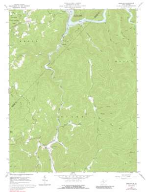
Erbacon Topo Map West Virginia
To zoom in, hover over the map of Erbacon
USGS Topo Quad 38080e5 - 1:24,000 scale
| Topo Map Name: | Erbacon |
| USGS Topo Quad ID: | 38080e5 |
| Print Size: | ca. 21 1/4" wide x 27" high |
| Southeast Coordinates: | 38.5° N latitude / 80.5° W longitude |
| Map Center Coordinates: | 38.5625° N latitude / 80.5625° W longitude |
| U.S. State: | WV |
| Filename: | o38080e5.jpg |
| Download Map JPG Image: | Erbacon topo map 1:24,000 scale |
| Map Type: | Topographic |
| Topo Series: | 7.5´ |
| Map Scale: | 1:24,000 |
| Source of Map Images: | United States Geological Survey (USGS) |
| Alternate Map Versions: |
Erbacon WV 1967, updated 1968 Download PDF Buy paper map Erbacon WV 1967, updated 1989 Download PDF Buy paper map Erbacon WV 1997, updated 2003 Download PDF Buy paper map Erbacon WV 2010 Download PDF Buy paper map Erbacon WV 2014 Download PDF Buy paper map Erbacon WV 2016 Download PDF Buy paper map |
1:24,000 Topo Quads surrounding Erbacon
> Back to 38080e1 at 1:100,000 scale
> Back to 38080a1 at 1:250,000 scale
> Back to U.S. Topo Maps home
Erbacon topo map: Gazetteer
Erbacon: Populated Places
Centralia elevation 325m 1066′Defoe (historical) elevation 426m 1397′
Erbacon elevation 463m 1519′
Erbacon: Post Offices
Centralia Post Office elevation 323m 1059′Erbacon Post Office elevation 465m 1525′
Erbacon: Ridges
Poplar Ridge elevation 512m 1679′Spring Ridge elevation 623m 2043′
Erbacon: Streams
Bear Run elevation 291m 954′Brooks Creek elevation 341m 1118′
Brushy Fork elevation 506m 1660′
Camp Creek elevation 307m 1007′
Carpenter Fork elevation 459m 1505′
Cow Run elevation 305m 1000′
Gulf Run elevation 305m 1000′
Houston Run elevation 285m 935′
Laurel Creek elevation 287m 941′
Lick Creek elevation 326m 1069′
Lower Laurel Fork elevation 492m 1614′
Missouri Creek elevation 463m 1519′
Upper Laurel Fork elevation 512m 1679′
Whiteoak Run elevation 451m 1479′
Erbacon: Summits
Big Mountain elevation 710m 2329′Erbacon digital topo map on disk
Buy this Erbacon topo map showing relief, roads, GPS coordinates and other geographical features, as a high-resolution digital map file on DVD:
Western Virginia & Southern West Virginia
Buy digital topo maps: Western Virginia & Southern West Virginia


