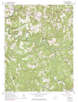
Herold Topo Map West Virginia
To zoom in, hover over the map of Herold
USGS Topo Quad 38080e7 - 1:24,000 scale
| Topo Map Name: | Herold |
| USGS Topo Quad ID: | 38080e7 |
| Print Size: | ca. 21 1/4" wide x 27" high |
| Southeast Coordinates: | 38.5° N latitude / 80.75° W longitude |
| Map Center Coordinates: | 38.5625° N latitude / 80.8125° W longitude |
| U.S. State: | WV |
| Filename: | o38080e7.jpg |
| Download Map JPG Image: | Herold topo map 1:24,000 scale |
| Map Type: | Topographic |
| Topo Series: | 7.5´ |
| Map Scale: | 1:24,000 |
| Source of Map Images: | United States Geological Survey (USGS) |
| Alternate Map Versions: |
Herold WV 1965, updated 1967 Download PDF Buy paper map Herold WV 1965, updated 1977 Download PDF Buy paper map Herold WV 2010 Download PDF Buy paper map Herold WV 2014 Download PDF Buy paper map Herold WV 2016 Download PDF Buy paper map |
1:24,000 Topo Quads surrounding Herold
> Back to 38080e1 at 1:100,000 scale
> Back to 38080a1 at 1:250,000 scale
> Back to U.S. Topo Maps home
Herold topo map: Gazetteer
Herold: Bays
Blue Hole elevation 253m 830′Herold: Crossings
Interchange 51 elevation 269m 882′Interchange 57 elevation 418m 1371′
Herold: Populated Places
Canfield elevation 340m 1115′Herold elevation 283m 928′
Meadville (historical) elevation 392m 1286′
Middle Run elevation 374m 1227′
Morris elevation 385m 1263′
Rockton elevation 241m 790′
Twistville (historical) elevation 308m 1010′
Wade elevation 446m 1463′
Herold: Ridges
Keener Ridge elevation 484m 1587′Middle Ridge elevation 460m 1509′
Runnion Ridge elevation 467m 1532′
Herold: Streams
Big Run elevation 336m 1102′Big Run elevation 249m 816′
Big Run elevation 327m 1072′
Brushy Fork elevation 310m 1017′
Buckeye Fork elevation 325m 1066′
Coalbed Run elevation 308m 1010′
Diatter Run elevation 250m 820′
Dry Fork elevation 246m 807′
Feedtrough Run elevation 314m 1030′
Frame Run elevation 259m 849′
Leatherwood Run elevation 244m 800′
Little Birch River elevation 303m 994′
Long Run elevation 286m 938′
Lower Mill Creek elevation 239m 784′
Lower Mill Creek elevation 331m 1085′
Middle Run elevation 254m 833′
Mill Creek elevation 337m 1105′
Polemic Run elevation 309m 1013′
Powell Creek elevation 337m 1105′
Road Run elevation 313m 1026′
Slabcamp Run elevation 327m 1072′
Spring Bottom Run elevation 334m 1095′
Sutton Run elevation 335m 1099′
Trace Fork elevation 318m 1043′
Wolf Pen Run elevation 275m 902′
Herold: Summits
Barnette Hill elevation 566m 1856′Coon Knob elevation 542m 1778′
Davis Knob elevation 470m 1541′
Fox Knob elevation 525m 1722′
James Knob elevation 462m 1515′
Herold digital topo map on disk
Buy this Herold topo map showing relief, roads, GPS coordinates and other geographical features, as a high-resolution digital map file on DVD:
Western Virginia & Southern West Virginia
Buy digital topo maps: Western Virginia & Southern West Virginia


