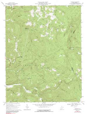
Goshen Topo Map West Virginia
To zoom in, hover over the map of Goshen
USGS Topo Quad 38080f3 - 1:24,000 scale
| Topo Map Name: | Goshen |
| USGS Topo Quad ID: | 38080f3 |
| Print Size: | ca. 21 1/4" wide x 27" high |
| Southeast Coordinates: | 38.625° N latitude / 80.25° W longitude |
| Map Center Coordinates: | 38.6875° N latitude / 80.3125° W longitude |
| U.S. State: | WV |
| Filename: | o38080f3.jpg |
| Download Map JPG Image: | Goshen topo map 1:24,000 scale |
| Map Type: | Topographic |
| Topo Series: | 7.5´ |
| Map Scale: | 1:24,000 |
| Source of Map Images: | United States Geological Survey (USGS) |
| Alternate Map Versions: |
Goshen WV 1967, updated 1969 Download PDF Buy paper map Goshen WV 1967, updated 1977 Download PDF Buy paper map Goshen WV 1967, updated 1991 Download PDF Buy paper map Goshen WV 2010 Download PDF Buy paper map Goshen WV 2014 Download PDF Buy paper map Goshen WV 2016 Download PDF Buy paper map |
1:24,000 Topo Quads surrounding Goshen
> Back to 38080e1 at 1:100,000 scale
> Back to 38080a1 at 1:250,000 scale
> Back to U.S. Topo Maps home
Goshen topo map: Gazetteer
Goshen: Falls
Tecumseh Falls elevation 675m 2214′Tenskwatawa Falls elevation 706m 2316′
Goshen: Flats
Bens Flats elevation 788m 2585′Goshen: Gaps
Big Run Gap elevation 691m 2267′Windy Gap elevation 827m 2713′
Goshen: Parks
Holly River State Park elevation 764m 2506′Goshen: Populated Places
Arvondale elevation 684m 2244′Canaan elevation 702m 2303′
Craddock elevation 626m 2053′
Eden elevation 587m 1925′
Goshen elevation 738m 2421′
Mayton (historical) elevation 791m 2595′
Penbro (historical) elevation 831m 2726′
Suncrest elevation 701m 2299′
Goshen: Springs
Edward T Balli Spring elevation 923m 3028′Goshen: Streams
Bee Run elevation 621m 2037′Big Lick Run elevation 670m 2198′
Big Run elevation 502m 1646′
Big Run elevation 569m 1866′
Birchpen Run elevation 597m 1958′
Conrad Fork elevation 582m 1909′
Crooked Fork elevation 582m 1909′
Devil Fork elevation 682m 2237′
Fall Run elevation 445m 1459′
Fall Run elevation 554m 1817′
Hell Run elevation 623m 2043′
Howell Fork elevation 523m 1715′
Johns Run elevation 502m 1646′
Left Fork Laurel Fork elevation 683m 2240′
Left Fork Right Fork Little Kanawha River elevation 404m 1325′
Long Run elevation 461m 1512′
Mader Run elevation 740m 2427′
Middle Fork Laurel Fork elevation 685m 2247′
Painter Run elevation 640m 2099′
Right Fork Laurel Fork elevation 683m 2240′
Rockcamp Run elevation 584m 1916′
Slab Camp Run elevation 468m 1535′
Snake Run elevation 613m 2011′
Spruce Fork elevation 585m 1919′
Spruce Run elevation 447m 1466′
Tater Knob Run elevation 513m 1683′
Turkey Fork elevation 512m 1679′
Goshen: Summits
Cleveland Mountain elevation 647m 2122′Haystack Knob elevation 662m 2171′
Potato Knob elevation 748m 2454′
Goshen: Trails
High Rock Trail elevation 703m 2306′Reverie Trail elevation 689m 2260′
Salt Lick Trail elevation 597m 1958′
Tramontane Trail elevation 697m 2286′
Wilderness Trail elevation 703m 2306′
Goshen: Valleys
Winterfield Hollow elevation 803m 2634′Goshen digital topo map on disk
Buy this Goshen topo map showing relief, roads, GPS coordinates and other geographical features, as a high-resolution digital map file on DVD:
Western Virginia & Southern West Virginia
Buy digital topo maps: Western Virginia & Southern West Virginia


