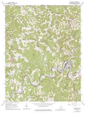
Gassaway Topo Map West Virginia
To zoom in, hover over the map of Gassaway
USGS Topo Quad 38080f7 - 1:24,000 scale
| Topo Map Name: | Gassaway |
| USGS Topo Quad ID: | 38080f7 |
| Print Size: | ca. 21 1/4" wide x 27" high |
| Southeast Coordinates: | 38.625° N latitude / 80.75° W longitude |
| Map Center Coordinates: | 38.6875° N latitude / 80.8125° W longitude |
| U.S. State: | WV |
| Filename: | o38080f7.jpg |
| Download Map JPG Image: | Gassaway topo map 1:24,000 scale |
| Map Type: | Topographic |
| Topo Series: | 7.5´ |
| Map Scale: | 1:24,000 |
| Source of Map Images: | United States Geological Survey (USGS) |
| Alternate Map Versions: |
Gassaway WV 1965, updated 1967 Download PDF Buy paper map Gassaway WV 1965, updated 1977 Download PDF Buy paper map Gassaway WV 2010 Download PDF Buy paper map Gassaway WV 2014 Download PDF Buy paper map Gassaway WV 2016 Download PDF Buy paper map |
1:24,000 Topo Quads surrounding Gassaway
> Back to 38080e1 at 1:100,000 scale
> Back to 38080a1 at 1:250,000 scale
> Back to U.S. Topo Maps home
Gassaway topo map: Gazetteer
Gassaway: Populated Places
Belfont elevation 276m 905′Chapel elevation 278m 912′
Clickton (historical) elevation 318m 1043′
Davison (historical) elevation 317m 1040′
Frametown elevation 253m 830′
Gassaway elevation 262m 859′
Home elevation 322m 1056′
Little Otter elevation 254m 833′
Shadyside elevation 252m 826′
Gassaway: Post Offices
Frametown Post Office elevation 249m 816′Gassaway: Streams
Bear Run elevation 245m 803′Big Run elevation 244m 800′
Big Run elevation 242m 793′
Bills Fork elevation 285m 935′
Blowntimber Run elevation 293m 961′
Brady Fork elevation 294m 964′
Brushy Branch elevation 248m 813′
Brushy Fork elevation 279m 915′
Buena Branch elevation 263m 862′
Canoe Run elevation 245m 803′
Coon Creek elevation 243m 797′
Grasslick Run elevation 280m 918′
Limestone Run elevation 285m 935′
Little Buffalo Creek elevation 245m 803′
Little Otter Creek elevation 245m 803′
Lower Rockcamp Run elevation 239m 784′
Panther Fork elevation 276m 905′
Perkins Branch elevation 303m 994′
Pigeon Run elevation 248m 813′
Plantation Fork elevation 276m 905′
Rockcamp Run elevation 244m 800′
Rush Fork elevation 248m 813′
Straight Fork elevation 285m 935′
Stumble Run elevation 241m 790′
Sugar Creek elevation 244m 800′
Sycamore Run elevation 246m 807′
Upper Mill Creek elevation 254m 833′
Walnut Fork elevation 257m 843′
Wolfpen Run elevation 281m 921′
Gassaway: Summits
Sugar Knob elevation 513m 1683′Gassaway digital topo map on disk
Buy this Gassaway topo map showing relief, roads, GPS coordinates and other geographical features, as a high-resolution digital map file on DVD:
Western Virginia & Southern West Virginia
Buy digital topo maps: Western Virginia & Southern West Virginia


