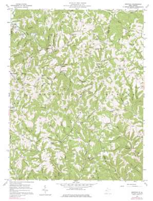
Kentuck Topo Map West Virginia
To zoom in, hover over the map of Kentuck
USGS Topo Quad 38081f5 - 1:24,000 scale
| Topo Map Name: | Kentuck |
| USGS Topo Quad ID: | 38081f5 |
| Print Size: | ca. 21 1/4" wide x 27" high |
| Southeast Coordinates: | 38.625° N latitude / 81.5° W longitude |
| Map Center Coordinates: | 38.6875° N latitude / 81.5625° W longitude |
| U.S. State: | WV |
| Filename: | o38081f5.jpg |
| Download Map JPG Image: | Kentuck topo map 1:24,000 scale |
| Map Type: | Topographic |
| Topo Series: | 7.5´ |
| Map Scale: | 1:24,000 |
| Source of Map Images: | United States Geological Survey (USGS) |
| Alternate Map Versions: |
Kentuck WV 1957, updated 1959 Download PDF Buy paper map Kentuck WV 1957, updated 1974 Download PDF Buy paper map Kentuck WV 1957, updated 1978 Download PDF Buy paper map Kentuck WV 2011 Download PDF Buy paper map Kentuck WV 2014 Download PDF Buy paper map Kentuck WV 2016 Download PDF Buy paper map |
1:24,000 Topo Quads surrounding Kentuck
> Back to 38081e1 at 1:100,000 scale
> Back to 38080a1 at 1:250,000 scale
> Back to U.S. Topo Maps home
Kentuck topo map: Gazetteer
Kentuck: Dams
Saltlick Creek Structure Number Nine Dam elevation 282m 925′Kentuck: Populated Places
Aplin (historical) elevation 292m 958′Belgrove elevation 207m 679′
Fletcher elevation 232m 761′
Higby (historical) elevation 243m 797′
July (historical) elevation 286m 938′
Kentuck elevation 281m 921′
Red Knob elevation 296m 971′
Statts Mills elevation 197m 646′
Vicars elevation 303m 994′
Kentuck: Post Offices
Kentuck Post Office elevation 283m 928′Kentuck: Ridges
Aplin Ridge elevation 290m 951′Jones Ridge elevation 323m 1059′
Limber Ridge elevation 293m 961′
Price Ridge elevation 314m 1030′
Price Ridge elevation 310m 1017′
Kentuck: Streams
Alumrock Run elevation 202m 662′Bear Fork elevation 198m 649′
Beech Fork elevation 213m 698′
Boardtree Run elevation 216m 708′
Cranenest Run elevation 196m 643′
Gandees Run elevation 196m 643′
Grasslick Creek elevation 198m 649′
Hickory Branch elevation 223m 731′
Laurel Fork elevation 220m 721′
Laurel Fork elevation 207m 679′
Laurel Run elevation 199m 652′
Leatherwood Run elevation 212m 695′
Left Fork Laurel Fork elevation 227m 744′
Little Wildcat Run elevation 199m 652′
Long Run elevation 207m 679′
Lower Big Run elevation 210m 688′
Lower Run elevation 199m 652′
Mudlick Run elevation 222m 728′
Pleasant Run elevation 237m 777′
Reed Creek elevation 220m 721′
Richards Run elevation 196m 643′
Right Fork Laurel Fork elevation 213m 698′
Spruce Run elevation 228m 748′
Straight Run elevation 198m 649′
Upper Big Run elevation 218m 715′
Wildcat Run elevation 199m 652′
Kentuck: Valleys
Anderson Hollow elevation 222m 728′Cat Hollow elevation 231m 757′
Doughty Hollow elevation 223m 731′
Good Hollow elevation 232m 761′
Hickory Hollow elevation 232m 761′
Loom Tree Hollow elevation 207m 679′
Payne Hollow elevation 228m 748′
Scott Hollow elevation 203m 666′
Spruce Hollow elevation 227m 744′
Walker Hollow elevation 246m 807′
Kentuck digital topo map on disk
Buy this Kentuck topo map showing relief, roads, GPS coordinates and other geographical features, as a high-resolution digital map file on DVD:
Western Virginia & Southern West Virginia
Buy digital topo maps: Western Virginia & Southern West Virginia


