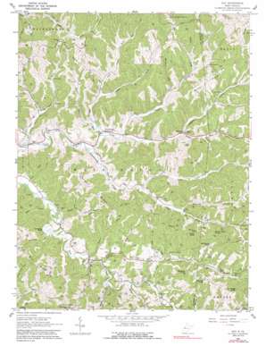
Gay Topo Map West Virginia
To zoom in, hover over the map of Gay
USGS Topo Quad 38081g5 - 1:24,000 scale
| Topo Map Name: | Gay |
| USGS Topo Quad ID: | 38081g5 |
| Print Size: | ca. 21 1/4" wide x 27" high |
| Southeast Coordinates: | 38.75° N latitude / 81.5° W longitude |
| Map Center Coordinates: | 38.8125° N latitude / 81.5625° W longitude |
| U.S. State: | WV |
| Filename: | o38081g5.jpg |
| Download Map JPG Image: | Gay topo map 1:24,000 scale |
| Map Type: | Topographic |
| Topo Series: | 7.5´ |
| Map Scale: | 1:24,000 |
| Source of Map Images: | United States Geological Survey (USGS) |
| Alternate Map Versions: |
Gay WV 1960, updated 1963 Download PDF Buy paper map Gay WV 1960, updated 1979 Download PDF Buy paper map Gay WV 1960, updated 1991 Download PDF Buy paper map Gay WV 2011 Download PDF Buy paper map Gay WV 2014 Download PDF Buy paper map Gay WV 2016 Download PDF Buy paper map |
1:24,000 Topo Quads surrounding Gay
> Back to 38081e1 at 1:100,000 scale
> Back to 38080a1 at 1:250,000 scale
> Back to U.S. Topo Maps home
Gay topo map: Gazetteer
Gay: Bends
Horseshoe Bend elevation 204m 669′Gay: Dams
Mill Creek Structure Number Four Dam elevation 202m 662′Gay: Flats
Berry Flats elevation 267m 875′Gay: Parks
Frozencamp Wildlife Management Area elevation 288m 944′Gay: Populated Places
Allentown elevation 247m 810′Antioch elevation 249m 816′
Buffalo (historical) elevation 206m 675′
Gay elevation 240m 787′
Hereford elevation 193m 633′
Lattimer elevation 220m 721′
Louther elevation 210m 688′
Marshall elevation 207m 679′
Gay: Post Offices
Gay Post Office elevation 241m 790′Gay: Ridges
Harmon Ridge elevation 312m 1023′Hart Ridge elevation 330m 1082′
Gay: Streams
Big Run elevation 194m 636′Billy Run elevation 208m 682′
Board Run elevation 198m 649′
Brush Run elevation 203m 666′
Bucket Run elevation 200m 656′
Buffalo Creek elevation 204m 669′
Claylick Run elevation 195m 639′
Forked Run elevation 200m 656′
Frozencamp Creek elevation 193m 633′
Haws Run elevation 201m 659′
Joes Run elevation 186m 610′
Left Fork Big Run elevation 200m 656′
Left Fork Elk Fork elevation 208m 682′
Left Fork Frozencamp Creek elevation 202m 662′
Left Fork Joes Run elevation 202m 662′
Little Creek elevation 194m 636′
McCrady Fork elevation 213m 698′
Mitchell Run elevation 206m 675′
Poplar Fork elevation 214m 702′
Poverty Fork elevation 190m 623′
Right Fork Big Run elevation 200m 656′
Right Fork Frozencamp Creek elevation 201m 659′
Right Fork Joes Run elevation 203m 666′
Rocklick Run elevation 195m 639′
Scale Run elevation 193m 633′
Spruce Run elevation 197m 646′
Wash Run elevation 217m 711′
Welch Run elevation 193m 633′
Gay: Summits
Buckeye Knob elevation 331m 1085′Four Ridge Knob elevation 340m 1115′
Marsh Hart Knob elevation 342m 1122′
McCraken Knob elevation 340m 1115′
Monroe Knob elevation 343m 1125′
Tuttle Knob elevation 343m 1125′
Gay: Valleys
Baby Hollow elevation 193m 633′Gay digital topo map on disk
Buy this Gay topo map showing relief, roads, GPS coordinates and other geographical features, as a high-resolution digital map file on DVD:
Western Virginia & Southern West Virginia
Buy digital topo maps: Western Virginia & Southern West Virginia


