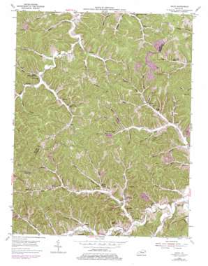
Mazie Topo Map Kentucky
To zoom in, hover over the map of Mazie
USGS Topo Quad 38082a8 - 1:24,000 scale
| Topo Map Name: | Mazie |
| USGS Topo Quad ID: | 38082a8 |
| Print Size: | ca. 21 1/4" wide x 27" high |
| Southeast Coordinates: | 38° N latitude / 82.875° W longitude |
| Map Center Coordinates: | 38.0625° N latitude / 82.9375° W longitude |
| U.S. State: | KY |
| Filename: | o38082a8.jpg |
| Download Map JPG Image: | Mazie topo map 1:24,000 scale |
| Map Type: | Topographic |
| Topo Series: | 7.5´ |
| Map Scale: | 1:24,000 |
| Source of Map Images: | United States Geological Survey (USGS) |
| Alternate Map Versions: |
Mazie KY 1953, updated 1955 Download PDF Buy paper map Mazie KY 1953, updated 1972 Download PDF Buy paper map Mazie KY 1953, updated 1979 Download PDF Buy paper map Mazie KY 2010 Download PDF Buy paper map Mazie KY 2013 Download PDF Buy paper map Mazie KY 2016 Download PDF Buy paper map |
1:24,000 Topo Quads surrounding Mazie
> Back to 38082a1 at 1:100,000 scale
> Back to 38082a1 at 1:250,000 scale
> Back to U.S. Topo Maps home
Mazie topo map: Gazetteer
Mazie: Populated Places
Blaines Trace elevation 239m 784′Blevins elevation 235m 770′
Cam Creek elevation 220m 721′
Culver elevation 224m 734′
Edsel elevation 240m 787′
Fielden elevation 226m 741′
Halcom elevation 228m 748′
Martha elevation 212m 695′
Mazie elevation 230m 754′
Sarah elevation 232m 761′
Skaggs elevation 218m 715′
Mazie: Post Offices
Blevins Post Office (historical) elevation 230m 754′Blevins Post Office (historical) elevation 219m 718′
Culver Post Office (historical) elevation 224m 734′
Edsel Post Office (historical) elevation 239m 784′
Fielding Post Office (historical) elevation 216m 708′
Halcome Post Office (historical) elevation 230m 754′
Martha Post Office elevation 217m 711′
Mazie Post Office (historical) elevation 230m 754′
Sacred Wind Post Office (historical) elevation 289m 948′
Sarah Post Office (historical) elevation 229m 751′
Skaggs Post Office (historical) elevation 219m 718′
Mazie: Reservoirs
Martha Fish Pond elevation 219m 718′Mazie: Streams
Bays Branch elevation 228m 748′Briar Fork elevation 212m 695′
Cam Creek elevation 212m 695′
Coalbank Branch elevation 213m 698′
Gillium Branch elevation 214m 702′
Greens Branch elevation 222m 728′
Hurricane Creek elevation 210m 688′
Jess Boggs Branch elevation 211m 692′
Jim Brown Branch elevation 208m 682′
Knob Branch elevation 199m 652′
Left Fork Blaine Creek elevation 204m 669′
Left Fork Cains Creek elevation 207m 679′
Lick Branch elevation 219m 718′
Lick Fork elevation 233m 764′
Lostlick Branch elevation 207m 679′
Lower Laurel Creek elevation 200m 656′
Meadow Branch elevation 223m 731′
Middle Branch Left Fork Cains Creek elevation 224m 734′
Mill Creek elevation 219m 718′
Mud Lick elevation 214m 702′
Nichols Fork elevation 225m 738′
Pigeonroost Branch elevation 230m 754′
Riggs Fork elevation 228m 748′
Right Fork Blaine Creek elevation 204m 669′
Right Fork Cains Creek elevation 207m 679′
Rock House Fork elevation 243m 797′
Rood Fork elevation 228m 748′
Salyers Branch elevation 210m 688′
Shop Branch of Blaine elevation 213m 698′
Spring Branch elevation 208m 682′
Steels Branch elevation 207m 679′
Sugartree Branch elevation 213m 698′
Upper Laurel Creek elevation 212m 695′
Wallow Hole Creek elevation 217m 711′
Whites Creek elevation 216m 708′
Whitley Branch elevation 206m 675′
Wiley Branch elevation 212m 695′
Mazie digital topo map on disk
Buy this Mazie topo map showing relief, roads, GPS coordinates and other geographical features, as a high-resolution digital map file on DVD:
Western Virginia & Southern West Virginia
Buy digital topo maps: Western Virginia & Southern West Virginia


