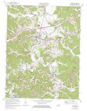
Grayson Topo Map Kentucky
To zoom in, hover over the map of Grayson
USGS Topo Quad 38082c8 - 1:24,000 scale
| Topo Map Name: | Grayson |
| USGS Topo Quad ID: | 38082c8 |
| Print Size: | ca. 21 1/4" wide x 27" high |
| Southeast Coordinates: | 38.25° N latitude / 82.875° W longitude |
| Map Center Coordinates: | 38.3125° N latitude / 82.9375° W longitude |
| U.S. State: | KY |
| Filename: | o38082c8.jpg |
| Download Map JPG Image: | Grayson topo map 1:24,000 scale |
| Map Type: | Topographic |
| Topo Series: | 7.5´ |
| Map Scale: | 1:24,000 |
| Source of Map Images: | United States Geological Survey (USGS) |
| Alternate Map Versions: |
Grayson KY 1953, updated 1954 Download PDF Buy paper map Grayson KY 1953, updated 1967 Download PDF Buy paper map Grayson KY 1971, updated 1973 Download PDF Buy paper map Grayson KY 1971, updated 1978 Download PDF Buy paper map Grayson KY 2010 Download PDF Buy paper map Grayson KY 2013 Download PDF Buy paper map Grayson KY 2016 Download PDF Buy paper map |
1:24,000 Topo Quads surrounding Grayson
> Back to 38082a1 at 1:100,000 scale
> Back to 38082a1 at 1:250,000 scale
> Back to U.S. Topo Maps home
Grayson topo map: Gazetteer
Grayson: Bridges
Barretts Creek Ford (historical) elevation 177m 580′Little Fork Bridge (historical) elevation 176m 577′
Grayson: Dams
Grayson Dam elevation 215m 705′Grayson: Flats
Mayhew Flats elevation 288m 944′Grayson: Lakes
Stevens Lake elevation 177m 580′Grayson: Parks
Camp Robert C. Webb (historical) elevation 213m 698′Sunrise Valley Golf and Country Club elevation 187m 613′
Grayson: Populated Places
Beech Grove elevation 189m 620′Fairview Hill elevation 213m 698′
Grayson elevation 193m 633′
Hitchins elevation 183m 600′
Leon elevation 185m 606′
Lindsey Chapel elevation 179m 587′
Mount Savage elevation 201m 659′
Pactolus elevation 177m 580′
Reedville elevation 187m 613′
Stinson elevation 195m 639′
Straight Creek elevation 193m 633′
The Cross Roads (historical) elevation 177m 580′
Grayson: Post Offices
Mount Savage Post Office (historical) elevation 185m 606′Reedville Post Office (historical) elevation 186m 610′
Grayson: Reservoirs
Grayson Lake elevation 215m 705′Grayson: Ridges
Greenbrier Ridge elevation 227m 744′Grayson: Streams
Barrett Creek elevation 171m 561′Beckwith Branch elevation 173m 567′
Big Sinking Creek elevation 181m 593′
Black Branch elevation 171m 561′
Canoe Run elevation 180m 590′
Damron Branch elevation 180m 590′
Davy Run elevation 182m 597′
Easterling Branch elevation 188m 616′
Everman Creek elevation 171m 561′
Fall Branch elevation 171m 561′
Fourmile Creek elevation 173m 567′
Fraley Branch elevation 183m 600′
Gum Branch elevation 185m 606′
Huff Run elevation 183m 600′
Johns Branch elevation 201m 659′
Katy Branch elevation 192m 629′
Little Fork Little Sandy River elevation 176m 577′
Little Huff Run elevation 192m 629′
Little Sinking Creek elevation 184m 603′
Lower Stinson Creek elevation 173m 567′
Powell Creek elevation 182m 597′
Righthand Fork Everman Creek elevation 179m 587′
Robin Run elevation 177m 580′
Stan Branch elevation 182m 597′
Straight Creek elevation 183m 600′
Tar Kill Branch elevation 190m 623′
Town Branch elevation 173m 567′
Upper Stinson Creek elevation 177m 580′
Wolf Creek elevation 173m 567′
Wolfpen Branch elevation 182m 597′
Grayson: Summits
Bald Eagle Hill elevation 240m 787′Hunts Knob elevation 332m 1089′
Tinsley Hill elevation 233m 764′
Grayson: Valleys
Bourbon Hollow elevation 177m 580′Carter Hollow elevation 183m 600′
Dark Hollow elevation 177m 580′
Hill Hollow elevation 186m 610′
Hurricane Hollow elevation 178m 583′
Pope Hollow elevation 179m 587′
Schoolhouse Hollow elevation 178m 583′
Grayson digital topo map on disk
Buy this Grayson topo map showing relief, roads, GPS coordinates and other geographical features, as a high-resolution digital map file on DVD:
Western Virginia & Southern West Virginia
Buy digital topo maps: Western Virginia & Southern West Virginia


