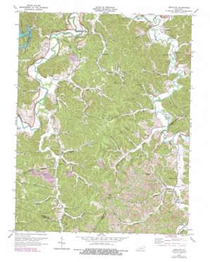
Argillite Topo Map Kentucky
To zoom in, hover over the map of Argillite
USGS Topo Quad 38082d7 - 1:24,000 scale
| Topo Map Name: | Argillite |
| USGS Topo Quad ID: | 38082d7 |
| Print Size: | ca. 21 1/4" wide x 27" high |
| Southeast Coordinates: | 38.375° N latitude / 82.75° W longitude |
| Map Center Coordinates: | 38.4375° N latitude / 82.8125° W longitude |
| U.S. State: | KY |
| Filename: | o38082d7.jpg |
| Download Map JPG Image: | Argillite topo map 1:24,000 scale |
| Map Type: | Topographic |
| Topo Series: | 7.5´ |
| Map Scale: | 1:24,000 |
| Source of Map Images: | United States Geological Survey (USGS) |
| Alternate Map Versions: |
Argillite KY 1953, updated 1955 Download PDF Buy paper map Argillite KY 1972, updated 1973 Download PDF Buy paper map Argillite KY 1972, updated 1978 Download PDF Buy paper map Argillite KY 2010 Download PDF Buy paper map Argillite KY 2013 Download PDF Buy paper map Argillite KY 2016 Download PDF Buy paper map |
1:24,000 Topo Quads surrounding Argillite
> Back to 38082a1 at 1:100,000 scale
> Back to 38082a1 at 1:250,000 scale
> Back to U.S. Topo Maps home
Argillite topo map: Gazetteer
Argillite: Flats
Kirby Flats elevation 215m 705′Argillite: Populated Places
Argillite elevation 165m 541′Danleyton elevation 188m 616′
Hunnewell elevation 176m 577′
Naples elevation 175m 574′
Argillite: Post Offices
Kimbler Post Office (historical) elevation 177m 580′Naples Post Office (historical) elevation 170m 557′
Williams Creek elevation 180m 590′
Argillite: Reservoirs
Greenbo Lake elevation 185m 606′Argillite: Streams
Bear Branch elevation 170m 557′Brush Creek elevation 170m 557′
Buena Vista Branch elevation 182m 597′
Cane Creek elevation 165m 541′
Caudle Branch elevation 182m 597′
Chadwick Creek elevation 169m 554′
Claylick Creek elevation 162m 531′
Coal Branch elevation 176m 577′
Cobb Fork elevation 181m 593′
Dugan Branch elevation 184m 603′
Far Fork Sandsuck Creek elevation 176m 577′
Henry Branch elevation 165m 541′
Indian Run elevation 169m 554′
John Branch elevation 178m 583′
Long Branch elevation 163m 534′
Lost Lick elevation 171m 561′
Moore Branch elevation 208m 682′
Near Fork Sandsuck Creek elevation 176m 577′
Old Stream Branch elevation 165m 541′
Patrick Branch elevation 190m 623′
Pigott Branch elevation 168m 551′
Sandsuck Creek elevation 165m 541′
Sawmill Branch elevation 169m 554′
Sinking Branch elevation 161m 528′
Skillet Handle Branch elevation 178m 583′
Straight Creek elevation 176m 577′
Tough Branch elevation 171m 561′
Tunnel Branch elevation 176m 577′
Turkey Lick elevation 176m 577′
Williams Creek elevation 171m 561′
Argillite: Summits
High Knob elevation 314m 1030′Argillite: Valleys
Lock Hollow elevation 181m 593′Logtown Hollow elevation 189m 620′
McCall Hollow elevation 181m 593′
Wildcat Hollow elevation 174m 570′
Argillite digital topo map on disk
Buy this Argillite topo map showing relief, roads, GPS coordinates and other geographical features, as a high-resolution digital map file on DVD:
Western Virginia & Southern West Virginia
Buy digital topo maps: Western Virginia & Southern West Virginia


