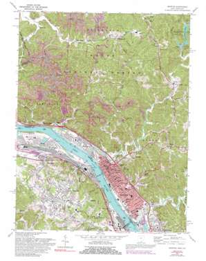
Ironton Topo Map Ohio
To zoom in, hover over the map of Ironton
USGS Topo Quad 38082e6 - 1:24,000 scale
| Topo Map Name: | Ironton |
| USGS Topo Quad ID: | 38082e6 |
| Print Size: | ca. 21 1/4" wide x 27" high |
| Southeast Coordinates: | 38.5° N latitude / 82.625° W longitude |
| Map Center Coordinates: | 38.5625° N latitude / 82.6875° W longitude |
| U.S. States: | OH, KY |
| Filename: | o38082e6.jpg |
| Download Map JPG Image: | Ironton topo map 1:24,000 scale |
| Map Type: | Topographic |
| Topo Series: | 7.5´ |
| Map Scale: | 1:24,000 |
| Source of Map Images: | United States Geological Survey (USGS) |
| Alternate Map Versions: |
Ironton OH 1953, updated 1955 Download PDF Buy paper map Ironton OH 1958, updated 1959 Download PDF Buy paper map Ironton OH 1961, updated 1963 Download PDF Buy paper map Ironton OH 1961, updated 1971 Download PDF Buy paper map Ironton OH 1972, updated 1974 Download PDF Buy paper map Ironton OH 1972, updated 1977 Download PDF Buy paper map Ironton OH 1972, updated 1985 Download PDF Buy paper map Ironton OH 1972, updated 1992 Download PDF Buy paper map Ironton OH 2002, updated 2006 Download PDF Buy paper map Ironton OH 2011 Download PDF Buy paper map Ironton OH 2013 Download PDF Buy paper map Ironton OH 2016 Download PDF Buy paper map |
| FStopo: | US Forest Service topo Ironton is available: Download FStopo PDF Download FStopo TIF |
1:24,000 Topo Quads surrounding Ironton
> Back to 38082e1 at 1:100,000 scale
> Back to 38082a1 at 1:250,000 scale
> Back to U.S. Topo Maps home
Ironton topo map: Gazetteer
Ironton: Airports
Ashland-Boyd County Airport elevation 166m 544′Ironton: Dams
Lake Vesuvius Dam elevation 194m 636′Pine Creek Structure Number Eight Dam elevation 182m 597′
Ironton: Parks
Beechwood Park elevation 172m 564′Fifth and Lawrence Streets Residential Historic District elevation 167m 547′
Rankin Historic District elevation 168m 551′
Vesuvius Recreation Area elevation 210m 688′
Ironton: Populated Places
Coal Grove elevation 176m 577′Coryville elevation 190m 623′
Ellisonville elevation 205m 672′
Etna elevation 189m 620′
Flatwoods elevation 208m 682′
Green Valley elevation 164m 538′
Hanging Rock elevation 165m 541′
Hecla elevation 184m 603′
Ironton elevation 168m 551′
La Grange elevation 177m 580′
Melrose elevation 168m 551′
New Castle elevation 201m 659′
Pine Grove elevation 189m 620′
Raceland elevation 166m 544′
Riverview elevation 171m 561′
Royersville elevation 201m 659′
Russell elevation 197m 646′
Russell Heights elevation 172m 564′
Three Oaks elevation 186m 610′
Vesuvius (historical) elevation 219m 718′
Vesuvius Furnace elevation 184m 603′
West Russell elevation 173m 567′
Worthington elevation 171m 561′
Ironton: Post Offices
Coalgrove Post Office (historical) elevation 176m 577′Hanging Rock Post Office elevation 165m 541′
Hecla Post Office (historical) elevation 187m 613′
Ironton Post Office elevation 168m 551′
Vesuvius Post Office (historical) elevation 224m 734′
Ironton: Reservoirs
Lake Vesuvius elevation 194m 636′Pine Creek Structure Number Eight Reservoir elevation 182m 597′
Ironton: Streams
Bear Run elevation 157m 515′Hecla Branch Storms Creek elevation 160m 524′
Hog Run elevation 163m 534′
Ice Creek elevation 157m 515′
Islington Run elevation 162m 531′
Little Ice Creek elevation 159m 521′
Meade Run elevation 157m 515′
Norman Run elevation 157m 515′
Norris Branch elevation 168m 551′
Osborne Run elevation 158m 518′
Polecat Branch Hag Run elevation 178m 583′
Storms Creek elevation 158m 518′
Union Branch elevation 171m 561′
White Oak Creek elevation 158m 518′
Yellow Branch elevation 156m 511′
Ironton: Valleys
Cecil Hollow elevation 185m 606′Fisher Hollow elevation 201m 659′
Irish Hollow elevation 207m 679′
Kennedy Hollow elevation 165m 541′
Long Bridge Hollow elevation 162m 531′
Richey Hollow elevation 178m 583′
Short Hollow elevation 188m 616′
Slope Hollow elevation 189m 620′
Toad Hollow elevation 213m 698′
Ironton digital topo map on disk
Buy this Ironton topo map showing relief, roads, GPS coordinates and other geographical features, as a high-resolution digital map file on DVD:
Western Virginia & Southern West Virginia
Buy digital topo maps: Western Virginia & Southern West Virginia


