Load Topo Map Kentucky
To zoom in, hover over the map of Load
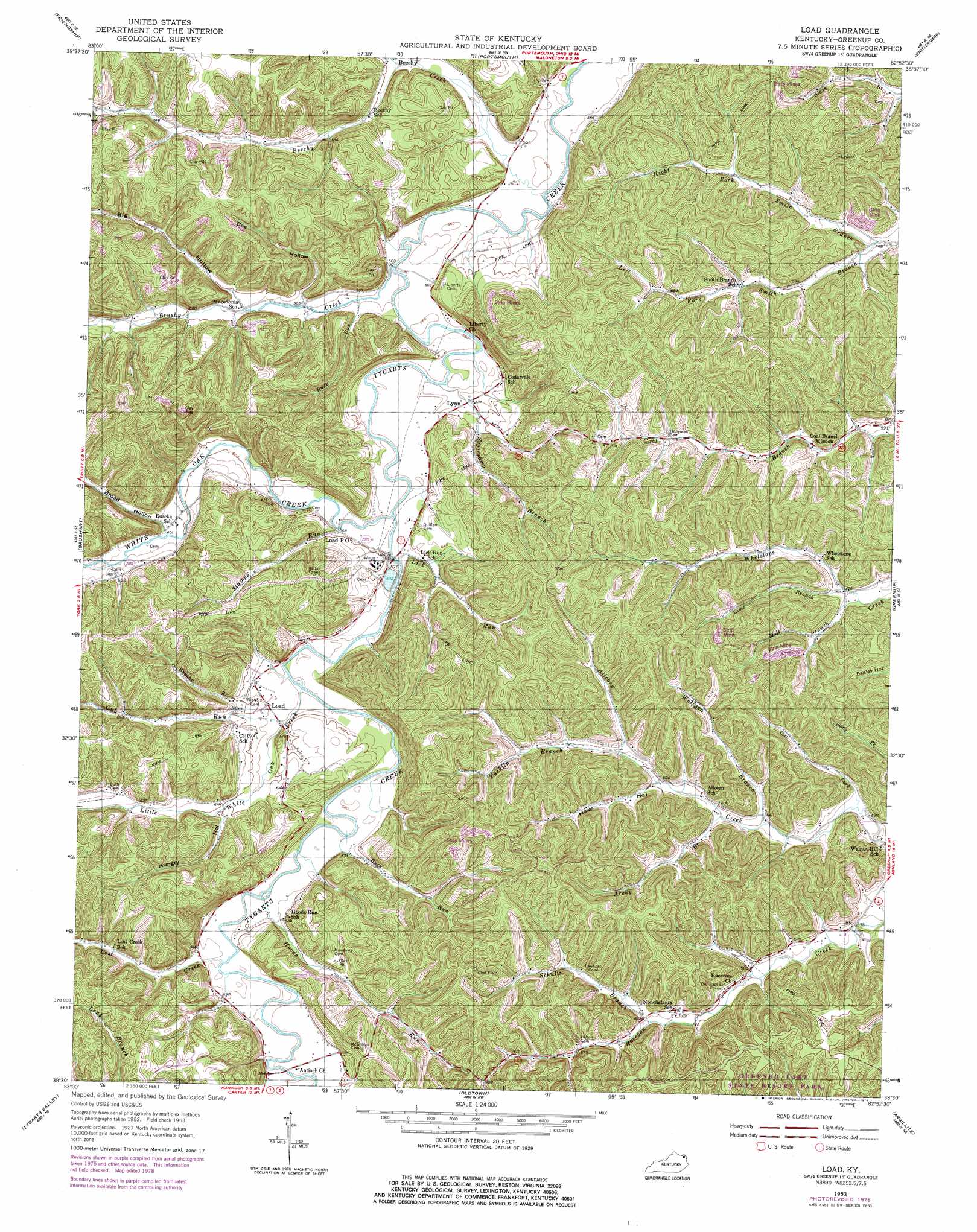
USGS Topo Quad 38082e8 - 1:24,000 scale
| Topo Map Name: | Load |
| USGS Topo Quad ID: | 38082e8 |
| Print Size: | ca. 21 1/4" wide x 27" high |
| Southeast Coordinates: | 38.5° N latitude / 82.875° W longitude |
| Map Center Coordinates: | 38.5625° N latitude / 82.9375° W longitude |
| U.S. State: | KY |
| Filename: | o38082e8.jpg |
| Download Map JPG Image: | Load topo map 1:24,000 scale |
| Map Type: | Topographic |
| Topo Series: | 7.5´ |
| Map Scale: | 1:24,000 |
| Source of Map Images: | United States Geological Survey (USGS) |
| Alternate Map Versions: |
Load KY 1953, updated 1955 Download PDF Buy paper map Load KY 1953, updated 1978 Download PDF Buy paper map Load KY 2010 Download PDF Buy paper map Load KY 2013 Download PDF Buy paper map Load KY 2016 Download PDF Buy paper map |
1:24,000 Topo Quads surrounding Load
Otway |
West Portsmouth |
New Boston |
Minford |
South Webster |
Pond Run |
Friendship |
Portsmouth |
Wheelersburg |
Pedro |
Garrison |
Brushart |
Load |
Greenup |
Ironton |
Wesleyville |
Tygarts Valley |
Oldtown |
Argillite |
Ashland |
Olive Hill |
Grahn |
Grayson |
Rush |
Boltsfork |
> Back to 38082e1 at 1:100,000 scale
> Back to 38082a1 at 1:250,000 scale
> Back to U.S. Topo Maps home
Load topo map: Gazetteer
Load: Populated Places
Beechy elevation 180m 590′Load elevation 176m 577′
Lynn elevation 176m 577′
Load: Post Offices
Load Post Office elevation 176m 577′Load: Streams
Archy Branch elevation 170m 557′Beechy Creek elevation 166m 544′
Blackbird Branch elevation 177m 580′
Brushy Branch elevation 182m 597′
Brushy Creek elevation 165m 541′
Buck Run elevation 171m 561′
Buck Run elevation 169m 554′
Cat Fork elevation 161m 528′
Cub Run elevation 176m 577′
Hoods Run elevation 171m 561′
Left Fork Smith Branch elevation 166m 544′
Lick Run elevation 173m 567′
Lime Branch elevation 174m 570′
Little Oak Creek elevation 170m 557′
Lost Creek elevation 172m 564′
Mill Branch elevation 172m 564′
Right Fork Smith Branch elevation 166m 544′
Schultz Branch elevation 201m 659′
Stumps Run elevation 173m 567′
Sugarcamp Branch elevation 169m 554′
Tarkiln Branch elevation 191m 626′
White Oak Creek elevation 171m 561′
Wolfpen Branch elevation 167m 547′
Load: Valleys
Bee Hollow elevation 176m 577′Big Hollow elevation 182m 597′
Broad Hollow elevation 185m 606′
Howe Hollow elevation 182m 597′
Hungry Hollow elevation 187m 613′
Load digital topo map on disk
Buy this Load topo map showing relief, roads, GPS coordinates and other geographical features, as a high-resolution digital map file on DVD:
Western Virginia & Southern West Virginia
Buy digital topo maps: Western Virginia & Southern West Virginia