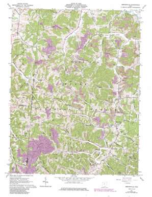
Mercerville Topo Map Ohio
To zoom in, hover over the map of Mercerville
USGS Topo Quad 38082f3 - 1:24,000 scale
| Topo Map Name: | Mercerville |
| USGS Topo Quad ID: | 38082f3 |
| Print Size: | ca. 21 1/4" wide x 27" high |
| Southeast Coordinates: | 38.625° N latitude / 82.25° W longitude |
| Map Center Coordinates: | 38.6875° N latitude / 82.3125° W longitude |
| U.S. State: | OH |
| Filename: | o38082f3.jpg |
| Download Map JPG Image: | Mercerville topo map 1:24,000 scale |
| Map Type: | Topographic |
| Topo Series: | 7.5´ |
| Map Scale: | 1:24,000 |
| Source of Map Images: | United States Geological Survey (USGS) |
| Alternate Map Versions: |
Mercerville OH 1961, updated 1963 Download PDF Buy paper map Mercerville OH 1961, updated 1973 Download PDF Buy paper map Mercerville OH 1961, updated 1977 Download PDF Buy paper map Mercerville OH 1961, updated 1985 Download PDF Buy paper map Mercerville OH 2002, updated 2006 Download PDF Buy paper map Mercerville OH 2011 Download PDF Buy paper map Mercerville OH 2013 Download PDF Buy paper map Mercerville OH 2016 Download PDF Buy paper map |
| FStopo: | US Forest Service topo Mercerville is available: Download FStopo PDF Download FStopo TIF |
1:24,000 Topo Quads surrounding Mercerville
> Back to 38082e1 at 1:100,000 scale
> Back to 38082a1 at 1:250,000 scale
> Back to U.S. Topo Maps home
Mercerville topo map: Gazetteer
Mercerville: Dams
Nobles Paradise Lake Dam elevation 256m 839′Mercerville: Populated Places
Angel elevation 172m 564′Boggs (historical) elevation 200m 656′
Hilton (historical) elevation 186m 610′
Hollis (historical) elevation 206m 675′
Leaper elevation 201m 659′
Mercerville elevation 234m 767′
Moody (historical) elevation 210m 688′
Okey elevation 228m 748′
Ruby (historical) elevation 311m 1020′
Saundersville elevation 275m 902′
Mercerville: Post Offices
Angel Post Office (historical) elevation 172m 564′Boggs Post Office (historical) elevation 202m 662′
Hilton Post Office (historical) elevation 186m 610′
Hollis Post Office (historical) elevation 207m 679′
Leaper Post Office (historical) elevation 215m 705′
Mercerville Post Office (historical) elevation 234m 767′
Moody Post Office (historical) elevation 213m 698′
Okey Post Office (historical) elevation 232m 761′
Ruby Post Office (historical) elevation 317m 1040′
Mercerville: Reservoirs
Nobles Paradise Lake elevation 256m 839′Mercerville: Streams
Burnt Run elevation 181m 593′Drake Fork Indian Guyan Creek elevation 206m 675′
Johns Creek elevation 203m 666′
Lanes Branch elevation 209m 685′
Little Bullskin Creek elevation 176m 577′
Little Perigen Creek elevation 216m 708′
Perigen Creek elevation 215m 705′
Rocklick Creek elevation 191m 626′
Rocky Fork elevation 204m 669′
Mercerville digital topo map on disk
Buy this Mercerville topo map showing relief, roads, GPS coordinates and other geographical features, as a high-resolution digital map file on DVD:
Western Virginia & Southern West Virginia
Buy digital topo maps: Western Virginia & Southern West Virginia


