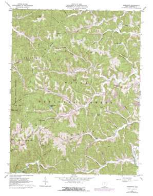
Sherritts Topo Map Ohio
To zoom in, hover over the map of Sherritts
USGS Topo Quad 38082f5 - 1:24,000 scale
| Topo Map Name: | Sherritts |
| USGS Topo Quad ID: | 38082f5 |
| Print Size: | ca. 21 1/4" wide x 27" high |
| Southeast Coordinates: | 38.625° N latitude / 82.5° W longitude |
| Map Center Coordinates: | 38.6875° N latitude / 82.5625° W longitude |
| U.S. State: | OH |
| Filename: | o38082f5.jpg |
| Download Map JPG Image: | Sherritts topo map 1:24,000 scale |
| Map Type: | Topographic |
| Topo Series: | 7.5´ |
| Map Scale: | 1:24,000 |
| Source of Map Images: | United States Geological Survey (USGS) |
| Alternate Map Versions: |
Sherritts OH 1961, updated 1963 Download PDF Buy paper map Sherritts OH 1961, updated 1972 Download PDF Buy paper map Sherritts OH 1961, updated 1977 Download PDF Buy paper map Sherritts OH 2002, updated 2006 Download PDF Buy paper map Sherritts OH 2011 Download PDF Buy paper map Sherritts OH 2013 Download PDF Buy paper map Sherritts OH 2016 Download PDF Buy paper map |
| FStopo: | US Forest Service topo Sherritts is available: Download FStopo PDF Download FStopo TIF |
1:24,000 Topo Quads surrounding Sherritts
> Back to 38082e1 at 1:100,000 scale
> Back to 38082a1 at 1:250,000 scale
> Back to U.S. Topo Maps home
Sherritts topo map: Gazetteer
Sherritts: Bridges
Nelson Bridge elevation 177m 580′Sherritts: Dams
George McClure Pond Dam elevation 216m 708′Izaak Walton Lake Dam elevation 229m 751′
Sherritts: Populated Places
Johns Creek (historical) elevation 203m 666′Sherritts elevation 193m 633′
Sherritts: Post Offices
Johns Creek Post Office (historical) elevation 202m 662′Sherritts Post Office (historical) elevation 188m 616′
Sherritts: Reservoirs
George McClure Pond elevation 216m 708′Izaak Walton Lake elevation 229m 751′
McClure Lake elevation 208m 682′
Sherritts: Ridges
Forest Ridge elevation 287m 941′Leet Ridge elevation 294m 964′
Tick Ridge elevation 276m 905′
Zoar Ridge elevation 304m 997′
Sherritts: Streams
Asbury Creek elevation 195m 639′Bakers Fork Buffalo Creek elevation 183m 600′
Beech Fork Buffalo Creek elevation 197m 646′
Brushy Buckeye Creek elevation 190m 623′
Buckeye Creek elevation 191m 626′
Caulley Creek elevation 185m 606′
Elkins Creek elevation 177m 580′
Handley Branch elevation 182m 597′
Paddle Creek elevation 187m 613′
Peters Run elevation 212m 695′
Slab Fork Johns Creek elevation 199m 652′
Sherritts: Summits
Phillips Knob elevation 306m 1003′Stewart Knob elevation 307m 1007′
Tipton Knob elevation 305m 1000′
Sherritts: Valleys
Aldridge Hollow elevation 189m 620′Arbaugh Hollow elevation 199m 652′
Cade Hollow elevation 211m 692′
Cedar Cliff Hollow elevation 187m 613′
Clarkson Hollow elevation 206m 675′
Dean Hollow elevation 216m 708′
Gum Stump Hollow elevation 184m 603′
Hungry Hollow elevation 197m 646′
Kanady Hollow elevation 199m 652′
Lambert Hollow elevation 217m 711′
Sam Miller Hollow elevation 184m 603′
Schweickart Hollow elevation 210m 688′
Shelton Hollow elevation 195m 639′
Townsend Hollow elevation 189m 620′
Waugh Hollow elevation 190m 623′
White Hollow elevation 215m 705′
White Hollow elevation 190m 623′
Woltz Hollow elevation 207m 679′
Sherritts digital topo map on disk
Buy this Sherritts topo map showing relief, roads, GPS coordinates and other geographical features, as a high-resolution digital map file on DVD:
Western Virginia & Southern West Virginia
Buy digital topo maps: Western Virginia & Southern West Virginia


