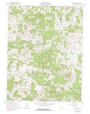
Petersburg Topo Map Ohio
To zoom in, hover over the map of Petersburg
USGS Topo Quad 38082h6 - 1:24,000 scale
| Topo Map Name: | Petersburg |
| USGS Topo Quad ID: | 38082h6 |
| Print Size: | ca. 21 1/4" wide x 27" high |
| Southeast Coordinates: | 38.875° N latitude / 82.625° W longitude |
| Map Center Coordinates: | 38.9375° N latitude / 82.6875° W longitude |
| U.S. State: | OH |
| Filename: | o38082h6.jpg |
| Download Map JPG Image: | Petersburg topo map 1:24,000 scale |
| Map Type: | Topographic |
| Topo Series: | 7.5´ |
| Map Scale: | 1:24,000 |
| Source of Map Images: | United States Geological Survey (USGS) |
| Alternate Map Versions: |
Petersburg OH 1961, updated 1962 Download PDF Buy paper map Petersburg OH 1961, updated 1978 Download PDF Buy paper map Petersburg OH 1961, updated 1990 Download PDF Buy paper map Petersburg OH 2010 Download PDF Buy paper map Petersburg OH 2013 Download PDF Buy paper map Petersburg OH 2016 Download PDF Buy paper map |
1:24,000 Topo Quads surrounding Petersburg
> Back to 38082e1 at 1:100,000 scale
> Back to 38082a1 at 1:250,000 scale
> Back to U.S. Topo Maps home
Petersburg topo map: Gazetteer
Petersburg: Airports
Russ Airport elevation 236m 774′Petersburg: Populated Places
Four Mile elevation 213m 698′Grahamsville elevation 234m 767′
Mabee Corner elevation 196m 643′
McCoy elevation 210m 688′
Petersburg elevation 219m 718′
Petersburg: Post Offices
Grahamsville Post Office (historical) elevation 234m 767′Petersburg: Ridges
Riegel Ridge elevation 272m 892′Petersburg: Streams
Jacko Run elevation 201m 659′Laurel Fork elevation 206m 675′
Little Bucklick Creek elevation 187m 613′
Scaffold Lick elevation 202m 662′
Petersburg: Valleys
Dark Hollow elevation 204m 669′Pigeonroost Hollow elevation 199m 652′
Petersburg: Woods
McCoy Grove elevation 196m 643′Petersburg digital topo map on disk
Buy this Petersburg topo map showing relief, roads, GPS coordinates and other geographical features, as a high-resolution digital map file on DVD:
Western Virginia & Southern West Virginia
Buy digital topo maps: Western Virginia & Southern West Virginia


