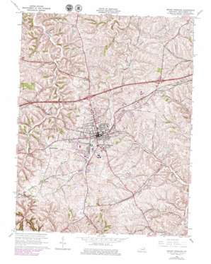
Mount Sterling Topo Map Kentucky
To zoom in, hover over the map of Mount Sterling
USGS Topo Quad 38083a8 - 1:24,000 scale
| Topo Map Name: | Mount Sterling |
| USGS Topo Quad ID: | 38083a8 |
| Print Size: | ca. 21 1/4" wide x 27" high |
| Southeast Coordinates: | 38° N latitude / 83.875° W longitude |
| Map Center Coordinates: | 38.0625° N latitude / 83.9375° W longitude |
| U.S. State: | KY |
| Filename: | o38083a8.jpg |
| Download Map JPG Image: | Mount Sterling topo map 1:24,000 scale |
| Map Type: | Topographic |
| Topo Series: | 7.5´ |
| Map Scale: | 1:24,000 |
| Source of Map Images: | United States Geological Survey (USGS) |
| Alternate Map Versions: |
Mount Sterling KY 1952, updated 1953 Download PDF Buy paper map Mount Sterling KY 1965, updated 1966 Download PDF Buy paper map Mount Sterling KY 1965, updated 1979 Download PDF Buy paper map Mount Sterling KY 2010 Download PDF Buy paper map Mount Sterling KY 2013 Download PDF Buy paper map Mount Sterling KY 2016 Download PDF Buy paper map |
1:24,000 Topo Quads surrounding Mount Sterling
> Back to 38083a1 at 1:100,000 scale
> Back to 38082a1 at 1:250,000 scale
> Back to U.S. Topo Maps home
Mount Sterling topo map: Gazetteer
Mount Sterling: Airports
Mount Sterling-Montgomery County Airport elevation 307m 1007′Mount Sterling: Parks
Woodland Park (historical) elevation 299m 980′Mount Sterling: Populated Places
Bogy-Chennault elevation 308m 1010′Calk elevation 300m 984′
Ewington elevation 307m 1007′
Klondike elevation 322m 1056′
Mount Sterling elevation 297m 974′
Pine Hill elevation 289m 948′
Prewitt elevation 320m 1049′
Reid Village elevation 318m 1043′
Rosedale elevation 307m 1007′
Smithville elevation 294m 964′
Mount Sterling: Post Offices
Donathon Post Office (historical) elevation 288m 944′Ewington Post Office (historical) elevation 304m 997′
Mount Sterling Post Office elevation 290m 951′
Mount Sterling: Streams
Sledd Creek elevation 255m 836′Mount Sterling digital topo map on disk
Buy this Mount Sterling topo map showing relief, roads, GPS coordinates and other geographical features, as a high-resolution digital map file on DVD:
Western Virginia & Southern West Virginia
Buy digital topo maps: Western Virginia & Southern West Virginia


