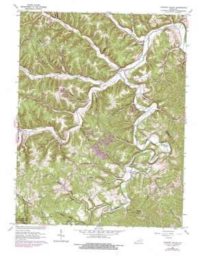
Tygarts Valley Topo Map Kentucky
To zoom in, hover over the map of Tygarts Valley
USGS Topo Quad 38083d1 - 1:24,000 scale
| Topo Map Name: | Tygarts Valley |
| USGS Topo Quad ID: | 38083d1 |
| Print Size: | ca. 21 1/4" wide x 27" high |
| Southeast Coordinates: | 38.375° N latitude / 83° W longitude |
| Map Center Coordinates: | 38.4375° N latitude / 83.0625° W longitude |
| U.S. State: | KY |
| Filename: | o38083d1.jpg |
| Download Map JPG Image: | Tygarts Valley topo map 1:24,000 scale |
| Map Type: | Topographic |
| Topo Series: | 7.5´ |
| Map Scale: | 1:24,000 |
| Source of Map Images: | United States Geological Survey (USGS) |
| Alternate Map Versions: |
Tygarts Valley KY 1950, updated 1952 Download PDF Buy paper map Tygarts Valley KY 1962, updated 1964 Download PDF Buy paper map Tygarts Valley KY 1962, updated 1978 Download PDF Buy paper map Tygarts Valley KY 2010 Download PDF Buy paper map Tygarts Valley KY 2013 Download PDF Buy paper map Tygarts Valley KY 2016 Download PDF Buy paper map |
1:24,000 Topo Quads surrounding Tygarts Valley
> Back to 38083a1 at 1:100,000 scale
> Back to 38082a1 at 1:250,000 scale
> Back to U.S. Topo Maps home
Tygarts Valley topo map: Gazetteer
Tygarts Valley: Airports
Praise God Airport elevation 328m 1076′Tygarts Valley: Flats
Robertson Flat elevation 277m 908′Tygarts Valley: Populated Places
Boone Furnace elevation 223m 731′Carter elevation 210m 688′
Charlotte Furnace elevation 254m 833′
Deevert elevation 209m 685′
Gesling elevation 201m 659′
Iron Hill elevation 200m 656′
Kehoe elevation 184m 603′
Tygarts Valley elevation 191m 626′
Wolf elevation 274m 898′
Tygarts Valley: Post Offices
Wolf Post Office elevation 286m 938′Tygarts Valley: Ridges
Sand Ridge elevation 319m 1046′Tygarts Valley: Streams
Adams Creek elevation 199m 652′Backs Branch elevation 188m 616′
Barnes Branch elevation 204m 669′
Buffalo Creek elevation 185m 606′
Clark Branch elevation 195m 639′
Colen Branch elevation 198m 649′
Elk Lick elevation 201m 659′
Friends Branch elevation 196m 643′
Grassy Creek elevation 189m 620′
Harvey Branch elevation 189m 620′
Hurricane Branch elevation 186m 610′
Leatherwood Branch elevation 182m 597′
Little Leatherwood Branch elevation 189m 620′
Ramey Branch elevation 189m 620′
Rock Springs Branch elevation 194m 636′
Ross Branch elevation 190m 623′
Shaws Branch elevation 186m 610′
Slate Lick elevation 246m 807′
Smith Creek elevation 205m 672′
South Fork Clark Branch elevation 204m 669′
Stumps Run elevation 225m 738′
Sutton Branch elevation 201m 659′
Thomas Branch elevation 199m 652′
Three Prong Branch elevation 184m 603′
Turkeypen Fork elevation 213m 698′
Wolf Creek elevation 186m 610′
Wolfpen Creek elevation 198m 649′
Zornes Branch elevation 191m 626′
Tygarts Valley: Summits
Potato Knob elevation 335m 1099′Tygarts Valley: Valleys
Blair Hollow elevation 207m 679′Grizzle Hollow elevation 197m 646′
Horn Hollow elevation 243m 797′
Old She Hollow elevation 183m 600′
Slash Hollow elevation 183m 600′
Whitehouse Hollow elevation 228m 748′
Tygarts Valley digital topo map on disk
Buy this Tygarts Valley topo map showing relief, roads, GPS coordinates and other geographical features, as a high-resolution digital map file on DVD:
Western Virginia & Southern West Virginia
Buy digital topo maps: Western Virginia & Southern West Virginia


