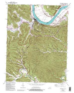
Vanceburg Topo Map Kentucky
To zoom in, hover over the map of Vanceburg
USGS Topo Quad 38083e3 - 1:24,000 scale
| Topo Map Name: | Vanceburg |
| USGS Topo Quad ID: | 38083e3 |
| Print Size: | ca. 21 1/4" wide x 27" high |
| Southeast Coordinates: | 38.5° N latitude / 83.25° W longitude |
| Map Center Coordinates: | 38.5625° N latitude / 83.3125° W longitude |
| U.S. States: | KY, OH |
| Filename: | o38083e3.jpg |
| Download Map JPG Image: | Vanceburg topo map 1:24,000 scale |
| Map Type: | Topographic |
| Topo Series: | 7.5´ |
| Map Scale: | 1:24,000 |
| Source of Map Images: | United States Geological Survey (USGS) |
| Alternate Map Versions: |
Vanceburg KY 1949, updated 1964 Download PDF Buy paper map Vanceburg KY 1949, updated 1973 Download PDF Buy paper map Vanceburg KY 1949, updated 1976 Download PDF Buy paper map Vanceburg KY 1949, updated 1995 Download PDF Buy paper map Vanceburg KY 1951 Download PDF Buy paper map Vanceburg KY 2010 Download PDF Buy paper map Vanceburg KY 2013 Download PDF Buy paper map Vanceburg KY 2016 Download PDF Buy paper map |
1:24,000 Topo Quads surrounding Vanceburg
> Back to 38083e1 at 1:100,000 scale
> Back to 38082a1 at 1:250,000 scale
> Back to U.S. Topo Maps home
Vanceburg topo map: Gazetteer
Vanceburg: Cliffs
Slate Point elevation 223m 731′Vanceburg: Flats
Irish Bottom elevation 165m 541′Kennedys Bottom elevation 157m 515′
Vanceburg: Parks
Ohio State Park elevation 168m 551′Vanceburg: Populated Places
Buena Vista elevation 189m 620′Clarksburg elevation 169m 554′
Kinniconick elevation 210m 688′
Rockville elevation 156m 511′
Sandy Springs elevation 178m 583′
Vanceburg elevation 164m 538′
Vanceburg: Post Offices
Kinniconick Post Office (historical) elevation 210m 688′Randville Post Office (historical) elevation 219m 718′
Sandy Springs Post Office (historical) elevation 178m 583′
Vanceburg: Ridges
Alum Rock Ridge elevation 330m 1082′Vanceburg: Streams
Appletree Branch elevation 173m 567′Axehandle Branch elevation 238m 780′
Blue Spring Branch elevation 161m 528′
Buck Lick elevation 224m 734′
Cat Branch elevation 262m 859′
Chestnut Branch elevation 225m 738′
Clarksburg Branch elevation 227m 744′
Clay Lick elevation 231m 757′
Coon Branch elevation 252m 826′
Dry Run elevation 152m 498′
Dyer Branch elevation 240m 787′
Fish Gut Branch elevation 153m 501′
Fly Branch elevation 158m 518′
Fuller Branch elevation 214m 702′
Gander Branch elevation 160m 524′
Gander Branch elevation 161m 528′
Gilpen Run elevation 156m 511′
Grassy Branch elevation 221m 725′
Groundhog Branch elevation 242m 793′
Gunnel Branch elevation 206m 675′
Hamilton Branch elevation 201m 659′
Hazel Branch elevation 161m 528′
Holly Branch elevation 211m 692′
Leatherwood Branch elevation 201m 659′
Machine Branch elevation 150m 492′
Matthews Branch elevation 219m 718′
McCall Run elevation 150m 492′
Mill Fork elevation 237m 777′
Miller Branch elevation 207m 679′
Neds Branch elevation 260m 853′
Pigpen Branch elevation 181m 593′
Rock Run elevation 149m 488′
Salt Lick Creek elevation 151m 495′
Sand Branch elevation 153m 501′
Schoolhouse Branch elevation 212m 695′
Shepherd Branch elevation 172m 564′
Spring Branch elevation 266m 872′
Sugar Tree Branch elevation 216m 708′
Thomas Branch elevation 224m 734′
Trout Branch elevation 212m 695′
Wesley Branch elevation 243m 797′
Vanceburg: Summits
Union Hill elevation 328m 1076′Vanceburg: Valleys
Backbone Hollow elevation 206m 675′Finger Board Hollow elevation 241m 790′
Griffin Hollow elevation 225m 738′
Nolan Hollow elevation 224m 734′
Puncheon Camp Hollow elevation 177m 580′
Slate Hollow elevation 168m 551′
Twin Hollows elevation 189m 620′
Vanceburg digital topo map on disk
Buy this Vanceburg topo map showing relief, roads, GPS coordinates and other geographical features, as a high-resolution digital map file on DVD:
Western Virginia & Southern West Virginia
Buy digital topo maps: Western Virginia & Southern West Virginia


