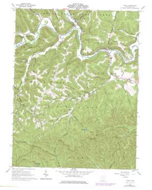
Otway Topo Map Ohio
To zoom in, hover over the map of Otway
USGS Topo Quad 38083g2 - 1:24,000 scale
| Topo Map Name: | Otway |
| USGS Topo Quad ID: | 38083g2 |
| Print Size: | ca. 21 1/4" wide x 27" high |
| Southeast Coordinates: | 38.75° N latitude / 83.125° W longitude |
| Map Center Coordinates: | 38.8125° N latitude / 83.1875° W longitude |
| U.S. State: | OH |
| Filename: | o38083g2.jpg |
| Download Map JPG Image: | Otway topo map 1:24,000 scale |
| Map Type: | Topographic |
| Topo Series: | 7.5´ |
| Map Scale: | 1:24,000 |
| Source of Map Images: | United States Geological Survey (USGS) |
| Alternate Map Versions: |
Otway OH 1961, updated 1962 Download PDF Buy paper map Otway OH 1961, updated 1970 Download PDF Buy paper map Otway OH 1961, updated 1984 Download PDF Buy paper map Otway OH 2010 Download PDF Buy paper map Otway OH 2013 Download PDF Buy paper map Otway OH 2016 Download PDF Buy paper map |
1:24,000 Topo Quads surrounding Otway
> Back to 38083e1 at 1:100,000 scale
> Back to 38082a1 at 1:250,000 scale
> Back to U.S. Topo Maps home
Otway topo map: Gazetteer
Otway: Airports
Yellowbird Farm Airport elevation 183m 600′Otway: Bridges
Otway Bridge elevation 177m 580′Otway: Dams
Bear Creek Lake Dam elevation 265m 869′Otway: Pillars
Alum Rock elevation 211m 692′Otway: Populated Places
Henley elevation 183m 600′Lombardsville elevation 220m 721′
Otway elevation 182m 597′
Otway: Post Offices
Lombardville Post Office (historical) elevation 220m 721′Otway Post Office elevation 183m 600′
Otway: Reservoirs
Bear Creek Lake elevation 265m 869′Wolfden Lake elevation 260m 853′
Otway: Ridges
Bracken Ridge elevation 330m 1082′Oswego Ridge elevation 302m 990′
Otway: Streams
Bear Creek elevation 170m 557′Beech Fork elevation 179m 587′
Bloody Run elevation 177m 580′
Canada Run elevation 177m 580′
Davis Run elevation 177m 580′
East Branch McCullough Creek elevation 170m 557′
Left Fork Bear Creek elevation 241m 790′
Little Spruce Run elevation 237m 777′
Long Fork Bear Creek elevation 225m 738′
Right Fork Bear Creek elevation 239m 784′
Rocky Fork elevation 177m 580′
Saw Pit Run elevation 176m 577′
Scantling Run elevation 258m 846′
Slate Run elevation 173m 567′
South Fork Scioto Brush Creek elevation 176m 577′
Spruce Run elevation 212m 695′
Stony Run elevation 176m 577′
Straight Fork Bear Creek elevation 242m 793′
Sugarcamp Run elevation 182m 597′
Watts Run elevation 218m 715′
Otway: Summits
Jones Knob elevation 260m 853′Otway: Valleys
Buttermilk Hollow elevation 220m 721′Honey Hollow elevation 189m 620′
Otway digital topo map on disk
Buy this Otway topo map showing relief, roads, GPS coordinates and other geographical features, as a high-resolution digital map file on DVD:
Western Virginia & Southern West Virginia
Buy digital topo maps: Western Virginia & Southern West Virginia


