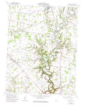
Hamersville Topo Map Ohio
To zoom in, hover over the map of Hamersville
USGS Topo Quad 38083h8 - 1:24,000 scale
| Topo Map Name: | Hamersville |
| USGS Topo Quad ID: | 38083h8 |
| Print Size: | ca. 21 1/4" wide x 27" high |
| Southeast Coordinates: | 38.875° N latitude / 83.875° W longitude |
| Map Center Coordinates: | 38.9375° N latitude / 83.9375° W longitude |
| U.S. State: | OH |
| Filename: | o38083h8.jpg |
| Download Map JPG Image: | Hamersville topo map 1:24,000 scale |
| Map Type: | Topographic |
| Topo Series: | 7.5´ |
| Map Scale: | 1:24,000 |
| Source of Map Images: | United States Geological Survey (USGS) |
| Alternate Map Versions: |
Hamersville OH 1960, updated 1962 Download PDF Buy paper map Hamersville OH 1960, updated 1976 Download PDF Buy paper map Hamersville OH 2010 Download PDF Buy paper map Hamersville OH 2013 Download PDF Buy paper map Hamersville OH 2016 Download PDF Buy paper map |
1:24,000 Topo Quads surrounding Hamersville
> Back to 38083e1 at 1:100,000 scale
> Back to 38082a1 at 1:250,000 scale
> Back to U.S. Topo Maps home
Hamersville topo map: Gazetteer
Hamersville: Airports
Brown County Airport elevation 289m 948′Hamersville: Bridges
Brown Bridge elevation 275m 902′New Hope Road Bridge elevation 262m 859′
Hamersville: Dams
Grant Lake Dam elevation 242m 793′Hamersville: Parks
Liming Park elevation 296m 971′Hamersville: Populated Places
Feesburg elevation 285m 935′Hamersville elevation 295m 967′
Neals Corner elevation 281m 921′
New Hope elevation 272m 892′
North Feesburg (historical) elevation 296m 971′
Shiloh elevation 286m 938′
Sunshine (historical) elevation 265m 869′
Wahlsburg elevation 290m 951′
White Oak Valley elevation 241m 790′
Whiteoak Springs (historical) elevation 285m 935′
Hamersville: Post Offices
Feesburg Post Office elevation 285m 935′Hagenbaugh Post Office (historical) elevation 295m 967′
Newhope Post Office (historical) elevation 272m 892′
Sunshine Post Office (historical) elevation 264m 866′
White Oak Valley Post Office (historical) elevation 241m 790′
Hamersville: Reservoirs
Grant Lake elevation 278m 912′Hamersville: Streams
Goose Run elevation 269m 882′Indian Run elevation 235m 770′
Miranda Run elevation 244m 800′
Polecat Run elevation 273m 895′
Shot Pouch Run elevation 251m 823′
Smiths Run elevation 255m 836′
Snapping Turtle Run elevation 279m 915′
Sterling Run elevation 262m 859′
Unity Creek elevation 240m 787′
Walnut Creek elevation 232m 761′
Hamersville: Valleys
Stony Hollow elevation 256m 839′Hamersville digital topo map on disk
Buy this Hamersville topo map showing relief, roads, GPS coordinates and other geographical features, as a high-resolution digital map file on DVD:
Western Virginia & Southern West Virginia
Buy digital topo maps: Western Virginia & Southern West Virginia


