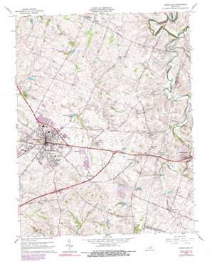
Versailles Topo Map Kentucky
To zoom in, hover over the map of Versailles
USGS Topo Quad 38084a6 - 1:24,000 scale
| Topo Map Name: | Versailles |
| USGS Topo Quad ID: | 38084a6 |
| Print Size: | ca. 21 1/4" wide x 27" high |
| Southeast Coordinates: | 38° N latitude / 84.625° W longitude |
| Map Center Coordinates: | 38.0625° N latitude / 84.6875° W longitude |
| U.S. State: | KY |
| Filename: | o38084a6.jpg |
| Download Map JPG Image: | Versailles topo map 1:24,000 scale |
| Map Type: | Topographic |
| Topo Series: | 7.5´ |
| Map Scale: | 1:24,000 |
| Source of Map Images: | United States Geological Survey (USGS) |
| Alternate Map Versions: |
Versailles KY 1954, updated 1955 Download PDF Buy paper map Versailles KY 1965, updated 1966 Download PDF Buy paper map Versailles KY 1965, updated 1979 Download PDF Buy paper map Versailles KY 1965, updated 1990 Download PDF Buy paper map Versailles KY 2010 Download PDF Buy paper map Versailles KY 2013 Download PDF Buy paper map Versailles KY 2016 Download PDF Buy paper map |
1:24,000 Topo Quads surrounding Versailles
> Back to 38084a1 at 1:100,000 scale
> Back to 38084a1 at 1:250,000 scale
> Back to U.S. Topo Maps home
Versailles topo map: Gazetteer
Versailles: Basins
Big Sink elevation 262m 859′Versailles: Bridges
Paynes Mill Bridge elevation 248m 813′Versailles: Populated Places
Bonita elevation 273m 895′Faywood elevation 249m 816′
Firmantown elevation 283m 928′
Fort Spring elevation 266m 872′
Frogtown elevation 265m 869′
Gaybourn elevation 285m 935′
Hunter Town elevation 290m 951′
Jacksontown (historical) elevation 275m 902′
Little Texas elevation 269m 882′
Nugent Crossroads elevation 259m 849′
Pisgah elevation 264m 866′
Shetland elevation 285m 935′
Versailles elevation 272m 892′
Wallace elevation 255m 836′
Westmoreland elevation 291m 954′
Woodford Village elevation 279m 915′
Zion Hill elevation 264m 866′
Versailles: Post Offices
Faywood Post Office (historical) elevation 249m 816′Nugent Post Office (historical) elevation 259m 849′
Pisgah Post Office (historical) elevation 280m 918′
Wallace Post Office (historical) elevation 250m 820′
Versailles: Reservoirs
Cooke Lake elevation 271m 889′Glen Lake elevation 263m 862′
Sportsman Club Lake elevation 264m 866′
Sycamore Lake elevation 280m 918′
Versailles: Streams
Manchester Branch elevation 249m 816′Shannon Run elevation 253m 830′
Sinking Creek elevation 260m 853′
Steeles Run elevation 246m 807′
Town Branch elevation 242m 793′
Versailles: Summits
Sugar Hill elevation 283m 928′Versailles digital topo map on disk
Buy this Versailles topo map showing relief, roads, GPS coordinates and other geographical features, as a high-resolution digital map file on DVD:


