North Middletown Topo Map Kentucky
To zoom in, hover over the map of North Middletown
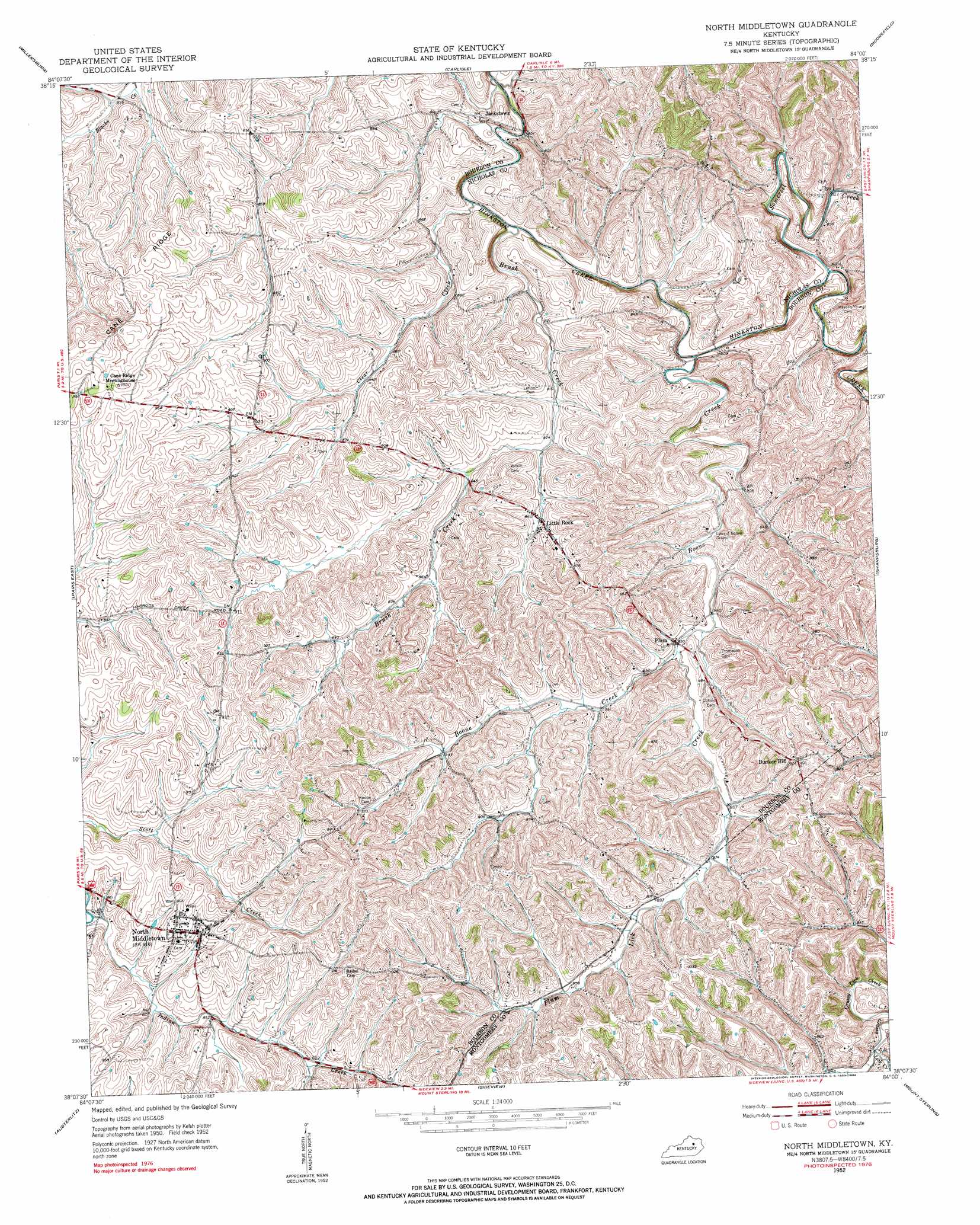
USGS Topo Quad 38084b1 - 1:24,000 scale
| Topo Map Name: | North Middletown |
| USGS Topo Quad ID: | 38084b1 |
| Print Size: | ca. 21 1/4" wide x 27" high |
| Southeast Coordinates: | 38.125° N latitude / 84° W longitude |
| Map Center Coordinates: | 38.1875° N latitude / 84.0625° W longitude |
| U.S. State: | KY |
| Filename: | o38084b1.jpg |
| Download Map JPG Image: | North Middletown topo map 1:24,000 scale |
| Map Type: | Topographic |
| Topo Series: | 7.5´ |
| Map Scale: | 1:24,000 |
| Source of Map Images: | United States Geological Survey (USGS) |
| Alternate Map Versions: |
North Middletown KY 1952, updated 1953 Download PDF Buy paper map North Middletown KY 2010 Download PDF Buy paper map North Middletown KY 2013 Download PDF Buy paper map North Middletown KY 2016 Download PDF Buy paper map |
1:24,000 Topo Quads surrounding North Middletown
Cynthiana |
Shady Nook |
Piqua |
Cowan |
Elizaville |
Shawhan |
Millersburg |
Carlisle |
Moorefield |
Sherburne |
Paris West |
Paris East |
North Middletown |
Sharpsburg |
Owingsville |
Clintonville |
Austerlitz |
Sideview |
Mount Sterling |
Preston |
Ford |
Winchester |
Hedges |
Levee |
Means |
> Back to 38084a1 at 1:100,000 scale
> Back to 38084a1 at 1:250,000 scale
> Back to U.S. Topo Maps home
North Middletown topo map: Gazetteer
North Middletown: Bridges
Fishback Bridge elevation 239m 784′Jackstown Bridge elevation 233m 764′
North Middletown: Populated Places
Aarons Run elevation 261m 856′Adeline (historical) elevation 253m 830′
Bunker Hill elevation 303m 994′
Colletts (historical) elevation 282m 925′
Jackstown elevation 250m 820′
Little Rock elevation 262m 859′
North Middletown elevation 279m 915′
Plum elevation 259m 849′
Plum Lick elevation 273m 895′
North Middletown: Post Offices
Aarons Run Post Office (historical) elevation 256m 839′North Middletown: Ridges
Cane Ridge elevation 268m 879′North Middletown: Streams
Aarons Run elevation 256m 839′Boone Creek elevation 245m 803′
Brush Creek elevation 239m 784′
Clear Creek elevation 236m 774′
Indian Creek elevation 249m 816′
Plum Lick Creek elevation 258m 846′
Somerset Creek elevation 240m 787′
Taylors Creek elevation 236m 774′
North Middletown: Summits
Five Forks Hill elevation 307m 1007′North Middletown digital topo map on disk
Buy this North Middletown topo map showing relief, roads, GPS coordinates and other geographical features, as a high-resolution digital map file on DVD: