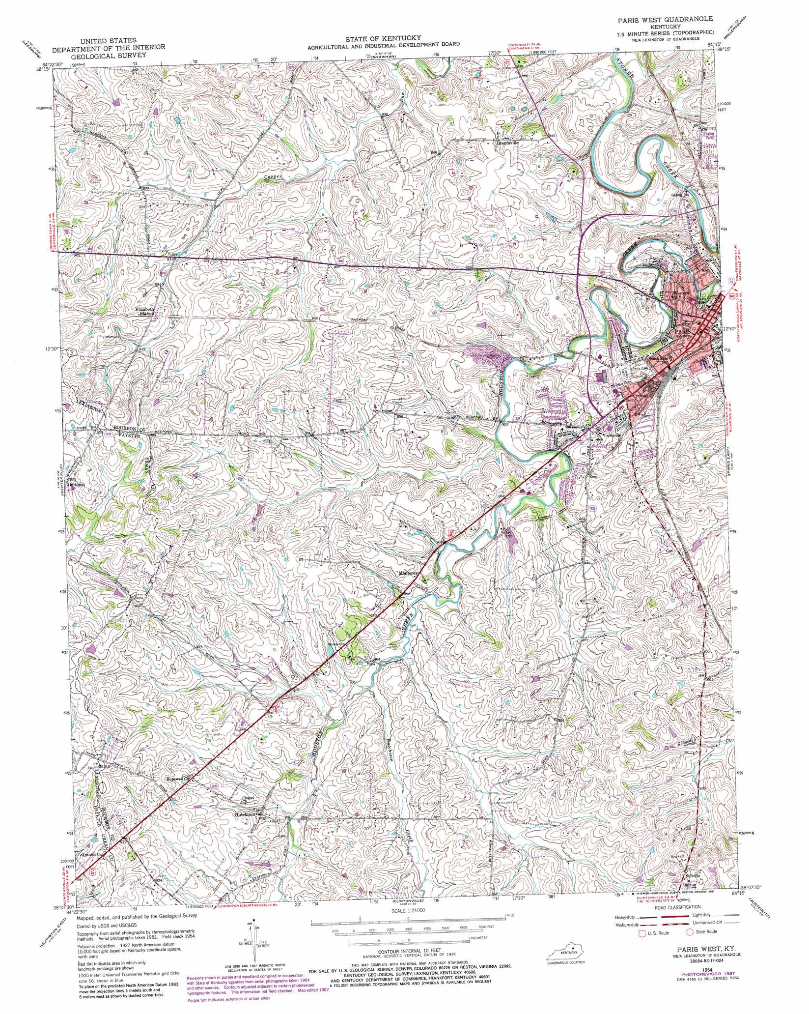
Paris West Topo Map Kentucky
To zoom in, hover over the map of Paris West
USGS Topo Quad 38084b3 - 1:24,000 scale
| Topo Map Name: | Paris West |
| USGS Topo Quad ID: | 38084b3 |
| Print Size: | ca. 21 1/4" wide x 27" high |
| Southeast Coordinates: | 38.125° N latitude / 84.25° W longitude |
| Map Center Coordinates: | 38.1875° N latitude / 84.3125° W longitude |
| U.S. State: | KY |
| Filename: | o38084b3.jpg |
| Download Map JPG Image: | Paris West topo map 1:24,000 scale |
| Map Type: | Topographic |
| Topo Series: | 7.5´ |
| Map Scale: | 1:24,000 |
| Source of Map Images: | United States Geological Survey (USGS) |
| Alternate Map Versions: |
Paris West KY 1954, updated 1955 Download PDF Buy paper map Paris West KY 1954, updated 1968 Download PDF Buy paper map Paris West KY 1954, updated 1979 Download PDF Buy paper map Paris West KY 1954, updated 1987 Download PDF Buy paper map Paris West KY 2010 Download PDF Buy paper map Paris West KY 2013 Download PDF Buy paper map Paris West KY 2016 Download PDF Buy paper map |
1:24,000 Topo Quads surrounding Paris West
Sadieville |
Breckinridge |
Cynthiana |
Shady Nook |
Piqua |
Delaplain |
Leesburg |
Shawhan |
Millersburg |
Carlisle |
Georgetown |
Centerville |
Paris West |
Paris East |
North Middletown |
Lexington West |
Lexington East |
Clintonville |
Austerlitz |
Sideview |
Nicholasville |
Coletown |
Ford |
Winchester |
Hedges |
> Back to 38084a1 at 1:100,000 scale
> Back to 38084a1 at 1:250,000 scale
> Back to U.S. Topo Maps home
Paris West topo map: Gazetteer
Paris West: Airports
Blue Haven Farm Airport elevation 299m 980′Brennan Farm Airport elevation 275m 902′
Zanzibar Farm Airport elevation 277m 908′
Paris West: Populated Places
Brentsville elevation 265m 869′Hutchison elevation 275m 902′
Jimtown elevation 297m 974′
Monterey elevation 267m 875′
Paris elevation 257m 843′
Sidville elevation 306m 1003′
Paris West: Streams
Hutchison Creek elevation 256m 839′Paris West digital topo map on disk
Buy this Paris West topo map showing relief, roads, GPS coordinates and other geographical features, as a high-resolution digital map file on DVD: