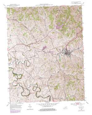
Carlisle Topo Map Kentucky
To zoom in, hover over the map of Carlisle
USGS Topo Quad 38084c1 - 1:24,000 scale
| Topo Map Name: | Carlisle |
| USGS Topo Quad ID: | 38084c1 |
| Print Size: | ca. 21 1/4" wide x 27" high |
| Southeast Coordinates: | 38.25° N latitude / 84° W longitude |
| Map Center Coordinates: | 38.3125° N latitude / 84.0625° W longitude |
| U.S. State: | KY |
| Filename: | o38084c1.jpg |
| Download Map JPG Image: | Carlisle topo map 1:24,000 scale |
| Map Type: | Topographic |
| Topo Series: | 7.5´ |
| Map Scale: | 1:24,000 |
| Source of Map Images: | United States Geological Survey (USGS) |
| Alternate Map Versions: |
Carlisle KY 1953, updated 1954 Download PDF Buy paper map Carlisle KY 1953, updated 1979 Download PDF Buy paper map Carlisle KY 2010 Download PDF Buy paper map Carlisle KY 2013 Download PDF Buy paper map Carlisle KY 2016 Download PDF Buy paper map |
1:24,000 Topo Quads surrounding Carlisle
> Back to 38084a1 at 1:100,000 scale
> Back to 38084a1 at 1:250,000 scale
> Back to U.S. Topo Maps home
Carlisle topo map: Gazetteer
Carlisle: Populated Places
Carlisle elevation 262m 859′Headquarters elevation 292m 958′
Hickory Ridge (historical) elevation 288m 944′
Carlisle: Post Offices
Bolton Post Office (historical) elevation 268m 879′Forest Retreat Post Office (historical) elevation 267m 875′
Headquarters Post Office (historical) elevation 290m 951′
Oakland Mills Post Office (historical) elevation 244m 800′
Carlisle: Reservoirs
Lake Cannigo elevation 261m 856′Carlisle: Ridges
Hickory Ridge elevation 289m 948′Irish Ridge elevation 292m 958′
Carlisle: Springs
Pleasant Springs (historical) elevation 255m 836′Carlisle: Streams
Blacks Creek elevation 235m 770′Brushy Creek elevation 230m 754′
Brushy Fork elevation 230m 754′
McBrides Run elevation 234m 767′
Wilbur Run elevation 241m 790′
Carlisle: Summits
Gallows Hill elevation 293m 961′Carlisle digital topo map on disk
Buy this Carlisle topo map showing relief, roads, GPS coordinates and other geographical features, as a high-resolution digital map file on DVD:


