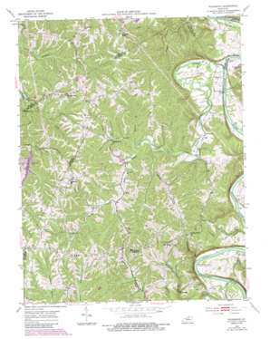
Polsgrove Topo Map Kentucky
To zoom in, hover over the map of Polsgrove
USGS Topo Quad 38084c8 - 1:24,000 scale
| Topo Map Name: | Polsgrove |
| USGS Topo Quad ID: | 38084c8 |
| Print Size: | ca. 21 1/4" wide x 27" high |
| Southeast Coordinates: | 38.25° N latitude / 84.875° W longitude |
| Map Center Coordinates: | 38.3125° N latitude / 84.9375° W longitude |
| U.S. State: | KY |
| Filename: | o38084c8.jpg |
| Download Map JPG Image: | Polsgrove topo map 1:24,000 scale |
| Map Type: | Topographic |
| Topo Series: | 7.5´ |
| Map Scale: | 1:24,000 |
| Source of Map Images: | United States Geological Survey (USGS) |
| Alternate Map Versions: |
Polsgrove KY 1953, updated 1955 Download PDF Buy paper map Polsgrove KY 1953, updated 1976 Download PDF Buy paper map Polsgrove KY 1953, updated 1984 Download PDF Buy paper map Polsgrove KY 1953, updated 1987 Download PDF Buy paper map Polsgrove KY 2010 Download PDF Buy paper map Polsgrove KY 2013 Download PDF Buy paper map Polsgrove KY 2016 Download PDF Buy paper map |
1:24,000 Topo Quads surrounding Polsgrove
> Back to 38084a1 at 1:100,000 scale
> Back to 38084a1 at 1:250,000 scale
> Back to U.S. Topo Maps home
Polsgrove topo map: Gazetteer
Polsgrove: Bends
Lecompte Bottom elevation 148m 485′Polsgrove: Flats
Polsgrove Bottom elevation 146m 479′Scotts Bottom elevation 142m 465′
Polsgrove: Parks
Kentucky River Campground elevation 149m 488′Polsgrove: Populated Places
Adamsville (historical) elevation 180m 590′Flag Fork elevation 205m 672′
Harp (historical) elevation 202m 662′
Harvieland elevation 186m 610′
Ottusville elevation 163m 534′
Polsgrove elevation 142m 465′
Shadrick Ferry (historical) elevation 189m 620′
Polsgrove: Post Offices
Baileys Store Post Office (historical) elevation 262m 859′Bald Knob Post Office (historical) elevation 253m 830′
Flag Fork Post Office (historical) elevation 203m 666′
Flat Creek Post Office (historical) elevation 147m 482′
Grubridge Post Office (historical) elevation 176m 577′
Harp Post Office (historical) elevation 203m 666′
Harvieland Post Office (historical) elevation 189m 620′
Joshua Post Office (historical) elevation 217m 711′
Laputa Post Office (historical) elevation 278m 912′
Ottusville Post Office (historical) elevation 161m 528′
Polsgrove Post Office (historical) elevation 148m 485′
Saffle Post Office (historical) elevation 253m 830′
Scrabble Post Office (historical) elevation 265m 869′
Scrabble Post Office (historical) elevation 215m 705′
Polsgrove: Reservoirs
Trailwood Lake elevation 212m 695′Polsgrove: Ridges
Dry Ridge elevation 273m 895′Grub Ridge elevation 243m 797′
Polsgrove: Springs
White Sulpher Spring (historical) elevation 206m 675′Polsgrove: Streams
Backbone Creek elevation 190m 623′East Fork Backbone Creek elevation 191m 626′
Flat Creek elevation 136m 446′
Goose Creek elevation 206m 675′
Grindstone Creek elevation 141m 462′
Little Flat Creek elevation 188m 616′
Marshall Branch elevation 181m 593′
Parks Branch Flat Creek elevation 166m 544′
Scrabble Creek elevation 201m 659′
Stony Creek elevation 138m 452′
Willow Branch elevation 194m 636′
Polsgrove: Summits
Bald Knob elevation 257m 843′Stoney Creek Hill elevation 241m 790′
Polsgrove: Valleys
Steamboat Hollow elevation 143m 469′Polsgrove digital topo map on disk
Buy this Polsgrove topo map showing relief, roads, GPS coordinates and other geographical features, as a high-resolution digital map file on DVD:


