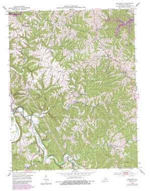
Monterey Topo Map Kentucky
To zoom in, hover over the map of Monterey
USGS Topo Quad 38084d7 - 1:24,000 scale
| Topo Map Name: | Monterey |
| USGS Topo Quad ID: | 38084d7 |
| Print Size: | ca. 21 1/4" wide x 27" high |
| Southeast Coordinates: | 38.375° N latitude / 84.75° W longitude |
| Map Center Coordinates: | 38.4375° N latitude / 84.8125° W longitude |
| U.S. State: | KY |
| Filename: | o38084d7.jpg |
| Download Map JPG Image: | Monterey topo map 1:24,000 scale |
| Map Type: | Topographic |
| Topo Series: | 7.5´ |
| Map Scale: | 1:24,000 |
| Source of Map Images: | United States Geological Survey (USGS) |
| Alternate Map Versions: |
Monterey KY 1953, updated 1954 Download PDF Buy paper map Monterey KY 1953, updated 1977 Download PDF Buy paper map Monterey KY 1953, updated 1987 Download PDF Buy paper map Monterey KY 2010 Download PDF Buy paper map Monterey KY 2013 Download PDF Buy paper map Monterey KY 2016 Download PDF Buy paper map |
1:24,000 Topo Quads surrounding Monterey
> Back to 38084a1 at 1:100,000 scale
> Back to 38084a1 at 1:250,000 scale
> Back to U.S. Topo Maps home
Monterey topo map: Gazetteer
Monterey: Populated Places
Hesler elevation 290m 951′Monterey elevation 150m 492′
New elevation 197m 646′
Teresita elevation 212m 695′
Monterey: Post Offices
East Eagle Post Office (historical) elevation 291m 954′Ep Post Office (historical) elevation 264m 866′
Greenup Fork Post Office (historical) elevation 265m 869′
Haydons Post Office (historical) elevation 287m 941′
Hesler Post Office (historical) elevation 286m 938′
Monterey Post Office (historical) elevation 148m 485′
Teresita Post Office (historical) elevation 212m 695′
Monterey: Ridges
Claxon Ridge elevation 287m 941′Paytons Ridge elevation 271m 889′
Monterey: Streams
Bowen Branch elevation 163m 534′Elk Lick Creek elevation 192m 629′
Greenup Creek elevation 200m 656′
Indian Creek elevation 187m 613′
Kays Branch elevation 178m 583′
McDowell Branch elevation 194m 636′
Morgadore Creek elevation 173m 567′
Plummer Branch elevation 189m 620′
Sawdridge Creek elevation 152m 498′
Slippery Rock Creek elevation 220m 721′
Wiley Branch elevation 219m 718′
Monterey: Summits
Honeysuckle Hill elevation 221m 725′Monterey digital topo map on disk
Buy this Monterey topo map showing relief, roads, GPS coordinates and other geographical features, as a high-resolution digital map file on DVD:


