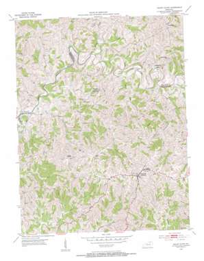
Mount Olivet Topo Map Kentucky
To zoom in, hover over the map of Mount Olivet
USGS Topo Quad 38084e1 - 1:24,000 scale
| Topo Map Name: | Mount Olivet |
| USGS Topo Quad ID: | 38084e1 |
| Print Size: | ca. 21 1/4" wide x 27" high |
| Southeast Coordinates: | 38.5° N latitude / 84° W longitude |
| Map Center Coordinates: | 38.5625° N latitude / 84.0625° W longitude |
| U.S. State: | KY |
| Filename: | o38084e1.jpg |
| Download Map JPG Image: | Mount Olivet topo map 1:24,000 scale |
| Map Type: | Topographic |
| Topo Series: | 7.5´ |
| Map Scale: | 1:24,000 |
| Source of Map Images: | United States Geological Survey (USGS) |
| Alternate Map Versions: |
Mount Olivet KY 1952, updated 1954 Download PDF Buy paper map Mount Olivet KY 2010 Download PDF Buy paper map Mount Olivet KY 2013 Download PDF Buy paper map Mount Olivet KY 2016 Download PDF Buy paper map |
1:24,000 Topo Quads surrounding Mount Olivet
> Back to 38084e1 at 1:100,000 scale
> Back to 38084a1 at 1:250,000 scale
> Back to U.S. Topo Maps home
Mount Olivet topo map: Gazetteer
Mount Olivet: Bridges
Drift Run Bridge (historical) elevation 186m 610′Mount Olivet: Populated Places
Belmont (historical) elevation 270m 885′Bratton elevation 206m 675′
Bridgeville elevation 197m 646′
Brierly Ridge (historical) elevation 264m 866′
Hittville elevation 265m 869′
Linville (historical) elevation 271m 889′
Mount Olivet elevation 285m 935′
Oakland elevation 247m 810′
Santa Fe elevation 194m 636′
Stonewall elevation 282m 925′
Mount Olivet: Post Offices
Belcourt Post Office (historical) elevation 279m 915′Bratton Post Office (historical) elevation 207m 679′
Bridgeville Post Office (historical) elevation 199m 652′
Hitts Post Office (historical) elevation 270m 885′
Mount Hope Post Office (historical) elevation 260m 853′
Santafe Post Office (historical) elevation 189m 620′
Sante Fe Post Office (historical) elevation 188m 616′
Mount Olivet: Ridges
Brierly Ridge elevation 256m 839′Mount Olivet: Streams
Brushy Fork elevation 198m 649′Camp Creek elevation 203m 666′
Drift Run elevation 189m 620′
Elms Run elevation 194m 636′
Flat Run elevation 188m 616′
Islands Run elevation 195m 639′
Little Panther Creek elevation 198m 649′
Mud Lick elevation 188m 616′
Panther Creek elevation 195m 639′
Salt Lick elevation 188m 616′
Stone Creek elevation 206m 675′
Willow Branch elevation 188m 616′
Mount Olivet digital topo map on disk
Buy this Mount Olivet topo map showing relief, roads, GPS coordinates and other geographical features, as a high-resolution digital map file on DVD:


