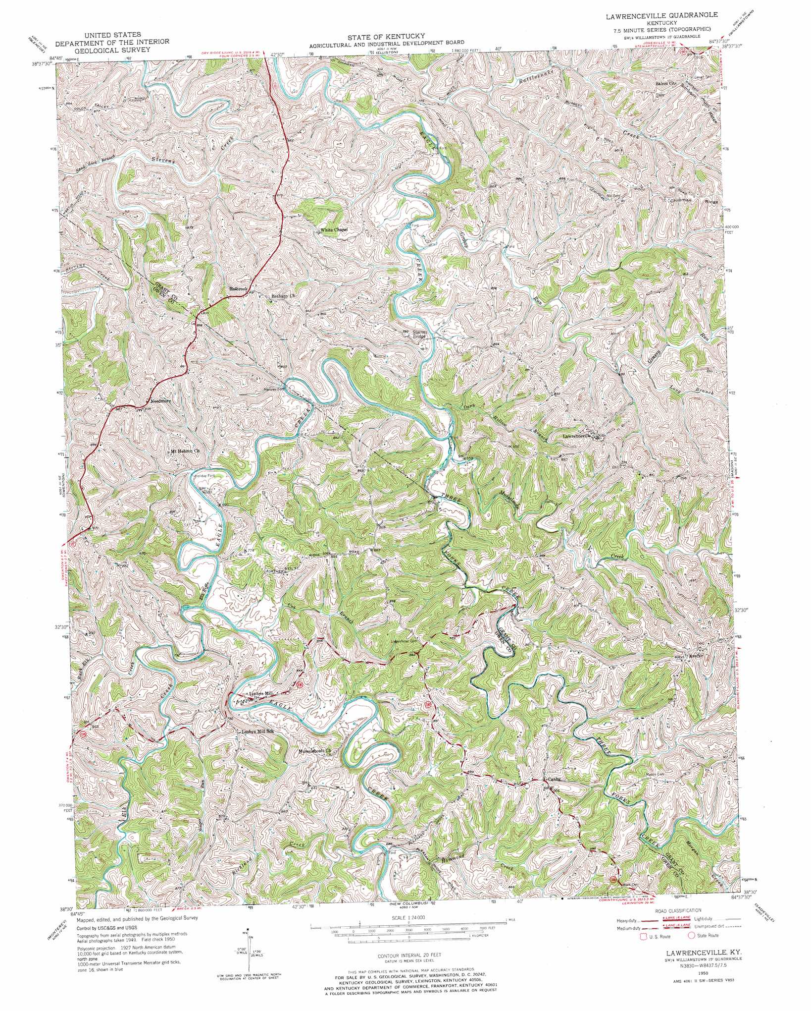
Lawrenceville Topo Map Kentucky
To zoom in, hover over the map of Lawrenceville
USGS Topo Quad 38084e6 - 1:24,000 scale
| Topo Map Name: | Lawrenceville |
| USGS Topo Quad ID: | 38084e6 |
| Print Size: | ca. 21 1/4" wide x 27" high |
| Southeast Coordinates: | 38.5° N latitude / 84.625° W longitude |
| Map Center Coordinates: | 38.5625° N latitude / 84.6875° W longitude |
| U.S. State: | KY |
| Filename: | o38084e6.jpg |
| Download Map JPG Image: | Lawrenceville topo map 1:24,000 scale |
| Map Type: | Topographic |
| Topo Series: | 7.5´ |
| Map Scale: | 1:24,000 |
| Source of Map Images: | United States Geological Survey (USGS) |
| Alternate Map Versions: |
Lawrenceville KY 1950, updated 1970 Download PDF Buy paper map Lawrenceville KY 2010 Download PDF Buy paper map Lawrenceville KY 2013 Download PDF Buy paper map Lawrenceville KY 2016 Download PDF Buy paper map |
1:24,000 Topo Quads surrounding Lawrenceville
Florence |
Patriot |
Verona |
Walton |
De Mossville |
Sanders |
Glencoe |
Elliston |
Williamstown |
Goforth |
New Liberty |
Owenton |
Lawrenceville |
Mason |
Berry |
Gratz |
Monterey |
New Columbus |
Sadieville |
Breckinridge |
Polsgrove |
Switzer |
Stamping Ground |
Delaplain |
Leesburg |
> Back to 38084e1 at 1:100,000 scale
> Back to 38084a1 at 1:250,000 scale
> Back to U.S. Topo Maps home
Lawrenceville topo map: Gazetteer
Lawrenceville: Bends
Horse Shoe Bend elevation 205m 672′Lawrenceville: Bridges
Starnes Bridge elevation 196m 643′Lawrenceville: Populated Places
Canby elevation 274m 898′Hensley Ford elevation 203m 666′
Holbrook elevation 268m 879′
Holiday Ford elevation 198m 649′
Keefer elevation 282m 925′
Lawrenceville elevation 276m 905′
Needmore elevation 270m 885′
Lawrenceville: Post Offices
Canby Post Office (historical) elevation 275m 902′Lusby Post Office (historical) elevation 223m 731′
Margaret Post Office (historical) elevation 265m 869′
Lawrenceville: Rapids
Elk Riffle elevation 198m 649′Lawrenceville: Ridges
Chipman Ridge elevation 270m 885′Lawrenceville: Streams
Buck Elk Creek elevation 201m 659′Coxs Branch elevation 205m 672′
Cub Branch elevation 199m 652′
Dark Hollow Branch elevation 192m 629′
Elk Creek elevation 199m 652′
Grassy Run elevation 189m 620′
Hammond Creek elevation 206m 675′
Long Branch elevation 213m 698′
Morgan Creek elevation 225m 738′
Musselman Creek elevation 206m 675′
Ram Branch elevation 209m 685′
Richland Creek elevation 206m 675′
Sand Lick Branch elevation 203m 666′
Singer Run elevation 208m 682′
Three Forks Creek elevation 194m 636′
Lawrenceville digital topo map on disk
Buy this Lawrenceville topo map showing relief, roads, GPS coordinates and other geographical features, as a high-resolution digital map file on DVD: