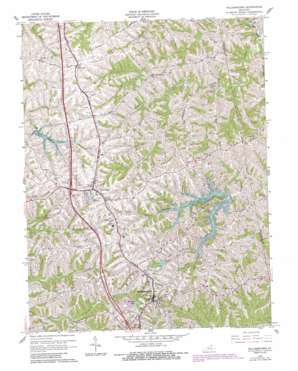
Williamstown Topo Map Kentucky
To zoom in, hover over the map of Williamstown
USGS Topo Quad 38084f5 - 1:24,000 scale
| Topo Map Name: | Williamstown |
| USGS Topo Quad ID: | 38084f5 |
| Print Size: | ca. 21 1/4" wide x 27" high |
| Southeast Coordinates: | 38.625° N latitude / 84.5° W longitude |
| Map Center Coordinates: | 38.6875° N latitude / 84.5625° W longitude |
| U.S. State: | KY |
| Filename: | o38084f5.jpg |
| Download Map JPG Image: | Williamstown topo map 1:24,000 scale |
| Map Type: | Topographic |
| Topo Series: | 7.5´ |
| Map Scale: | 1:24,000 |
| Source of Map Images: | United States Geological Survey (USGS) |
| Alternate Map Versions: |
Williamstown KY 1950, updated 1952 Download PDF Buy paper map Williamstown KY 1961, updated 1962 Download PDF Buy paper map Williamstown KY 1961, updated 1987 Download PDF Buy paper map Williamstown KY 2010 Download PDF Buy paper map Williamstown KY 2013 Download PDF Buy paper map Williamstown KY 2016 Download PDF Buy paper map |
1:24,000 Topo Quads surrounding Williamstown
> Back to 38084e1 at 1:100,000 scale
> Back to 38084a1 at 1:250,000 scale
> Back to U.S. Topo Maps home
Williamstown topo map: Gazetteer
Williamstown: Airports
Conrads Airport elevation 282m 925′Grant County Hospital Heliport elevation 272m 892′
Williamstown: Populated Places
Campbells Block House (historical) elevation 293m 961′Dry Ridge elevation 290m 951′
Knoxville elevation 282m 925′
Northcutt elevation 273m 895′
Sherman elevation 286m 938′
Williamstown elevation 296m 971′
Williamstown: Post Offices
Knoxville Post Office (historical) elevation 280m 918′Williamstown: Reservoirs
Bolz Lake elevation 250m 820′Lake Polliwog elevation 274m 898′
Railroad Lake elevation 265m 869′
Williamstown Lake elevation 234m 767′
Williamstown: Ridges
Fairview Ridge elevation 254m 833′Humes Ridge elevation 279m 915′
Williamstown: Streams
Goose Creek elevation 236m 774′Lake Branch elevation 236m 774′
Panther Run elevation 221m 725′
Steammill Branch elevation 231m 757′
Townsend Branch elevation 220m 721′
Williamstown digital topo map on disk
Buy this Williamstown topo map showing relief, roads, GPS coordinates and other geographical features, as a high-resolution digital map file on DVD:


