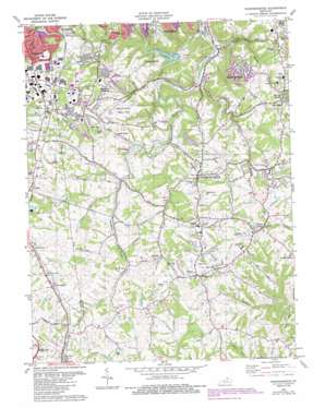
Independence Topo Map Kentucky
To zoom in, hover over the map of Independence
USGS Topo Quad 38084h5 - 1:24,000 scale
| Topo Map Name: | Independence |
| USGS Topo Quad ID: | 38084h5 |
| Print Size: | ca. 21 1/4" wide x 27" high |
| Southeast Coordinates: | 38.875° N latitude / 84.5° W longitude |
| Map Center Coordinates: | 38.9375° N latitude / 84.5625° W longitude |
| U.S. State: | KY |
| Filename: | o38084h5.jpg |
| Download Map JPG Image: | Independence topo map 1:24,000 scale |
| Map Type: | Topographic |
| Topo Series: | 7.5´ |
| Map Scale: | 1:24,000 |
| Source of Map Images: | United States Geological Survey (USGS) |
| Alternate Map Versions: |
Independence KY 1950, updated 1952 Download PDF Buy paper map Independence KY 1955, updated 1956 Download PDF Buy paper map Independence KY 1961, updated 1962 Download PDF Buy paper map Independence KY 1961, updated 1970 Download PDF Buy paper map Independence KY 1981, updated 1982 Download PDF Buy paper map Independence KY 1981, updated 1987 Download PDF Buy paper map Independence KY 2010 Download PDF Buy paper map Independence KY 2013 Download PDF Buy paper map Independence KY 2016 Download PDF Buy paper map |
1:24,000 Topo Quads surrounding Independence
> Back to 38084e1 at 1:100,000 scale
> Back to 38084a1 at 1:250,000 scale
> Back to U.S. Topo Maps home
Independence topo map: Gazetteer
Independence: Dams
Dam Number 3 elevation 199m 652′Dam Number Three elevation 200m 656′
Independence: Parks
Banklick Woods Park elevation 252m 826′Covered Bridge Park elevation 264m 866′
Doe Run Lake Park elevation 211m 692′
Kenton County Public Park elevation 267m 875′
Independence: Populated Places
Bank Lick elevation 253m 830′Devon elevation 289m 948′
Independence elevation 274m 898′
Kensington elevation 277m 908′
Nicholson elevation 283m 928′
Oak Ridge elevation 271m 889′
Ricedale elevation 235m 770′
Richwood elevation 283m 928′
Ridgeview Heights elevation 271m 889′
Staffordsburg elevation 263m 862′
Walton elevation 283m 928′
White Tower elevation 281m 921′
Independence: Post Offices
Bank Lick Post Office (historical) elevation 251m 823′Buffington Post Office (historical) elevation 277m 908′
Devon Post Office (historical) elevation 288m 944′
Grubb Post Office (historical) elevation 293m 961′
New Lancaster Post Office (historical) elevation 290m 951′
Nicholson Post Office (historical) elevation 283m 928′
Scott Post Office (historical) elevation 180m 590′
Staffordsburg Post Office (historical) elevation 263m 862′
Tower Post Office (historical) elevation 283m 928′
Independence: Streams
Brushy Fork elevation 212m 695′Bullock Pen Creek elevation 155m 508′
Doe Run Creek elevation 187m 613′
Fowler Creek elevation 168m 551′
Rice Creek elevation 227m 744′
Thompson Branch elevation 222m 728′
Wayman Branch elevation 164m 538′
Wolf Pen Branch elevation 233m 764′
Independence digital topo map on disk
Buy this Independence topo map showing relief, roads, GPS coordinates and other geographical features, as a high-resolution digital map file on DVD:


