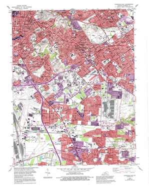
Louisville East Topo Map Kentucky
To zoom in, hover over the map of Louisville East
USGS Topo Quad 38085b6 - 1:24,000 scale
| Topo Map Name: | Louisville East |
| USGS Topo Quad ID: | 38085b6 |
| Print Size: | ca. 21 1/4" wide x 27" high |
| Southeast Coordinates: | 38.125° N latitude / 85.625° W longitude |
| Map Center Coordinates: | 38.1875° N latitude / 85.6875° W longitude |
| U.S. State: | KY |
| Filename: | o38085b6.jpg |
| Download Map JPG Image: | Louisville East topo map 1:24,000 scale |
| Map Type: | Topographic |
| Topo Series: | 7.5´ |
| Map Scale: | 1:24,000 |
| Source of Map Images: | United States Geological Survey (USGS) |
| Alternate Map Versions: |
Louisville East KY 1951 Download PDF Buy paper map Louisville East KY 1955, updated 1956 Download PDF Buy paper map Louisville East KY 1960, updated 1961 Download PDF Buy paper map Louisville East KY 1965, updated 1967 Download PDF Buy paper map Louisville East KY 1965, updated 1972 Download PDF Buy paper map Louisville East KY 1982, updated 1983 Download PDF Buy paper map Louisville East KY 1982, updated 1987 Download PDF Buy paper map Louisville East KY 1982, updated 1995 Download PDF Buy paper map Louisville East KY 2010 Download PDF Buy paper map Louisville East KY 2013 Download PDF Buy paper map Louisville East KY 2016 Download PDF Buy paper map |
1:24,000 Topo Quads surrounding Louisville East
> Back to 38085a1 at 1:100,000 scale
> Back to 38084a1 at 1:250,000 scale
> Back to U.S. Topo Maps home
Louisville East topo map: Gazetteer
Louisville East: Airports
Baptist Hospital East Heliport elevation 162m 531′Bowman Field elevation 166m 544′
Louisville International Airport elevation 144m 472′
University Hospital Heliport elevation 140m 459′
Louisville East: Canals
Greasy Ditch elevation 140m 459′Northern Ditch elevation 138m 452′
Southern Ditch elevation 138m 452′
Spring Ditch elevation 141m 462′
Wet Woods Creek elevation 139m 456′
Louisville East: Capes
Hikes Point elevation 171m 561′Louisville East: Crossings
Interchange 10 elevation 150m 492′Interchange 127 elevation 140m 459′
Interchange 128 elevation 141m 462′
Interchange 12A elevation 161m 528′
Interchange 130 elevation 147m 482′
Interchange 131A elevation 152m 498′
Interchange 131B elevation 149m 488′
Interchange 5 elevation 142m 465′
Interchange 6 elevation 151m 495′
Interchange 8 elevation 146m 479′
Louisville East: Lakes
Lakeside Pool elevation 159m 521′Lighthouse Lake elevation 143m 469′
Louisville East: Parks
Black Mud Park elevation 145m 475′Cardinal Stadium elevation 148m 485′
Cherokee Park elevation 135m 442′
Clark Park elevation 141m 462′
Du Pont Manual Stadium elevation 147m 482′
Highview Park elevation 197m 646′
Saint Michaels Park elevation 140m 459′
Seneca Park elevation 149m 488′
Shelby Park elevation 140m 459′
Taylor Memorial Park elevation 159m 521′
Tyler Park elevation 149m 488′
Louisville East: Populated Places
Audubon Park elevation 156m 511′Bon Air Estates elevation 151m 495′
Broad Fields elevation 165m 541′
Buechel elevation 152m 498′
Camp Taylor elevation 159m 521′
Cherokee Garden elevation 165m 541′
Fairmeade elevation 160m 524′
German Town elevation 148m 485′
Highgate Springs elevation 154m 505′
Highlands elevation 166m 544′
Kingsley elevation 163m 534′
Knopp elevation 139m 456′
Lynnview elevation 144m 472′
Meadowview Estates elevation 160m 524′
Newburg elevation 148m 485′
Norbourne Estates elevation 164m 538′
Okolona elevation 141m 462′
Parkside elevation 161m 528′
Parkway Village elevation 149m 488′
Petersburg elevation 152m 498′
Plymouth Village elevation 165m 541′
Poplar Hills elevation 143m 469′
Prestonia elevation 154m 505′
Seneca Gardens elevation 160m 524′
Smyrna elevation 185m 606′
Spring Mill elevation 201m 659′
Springlee elevation 162m 531′
Strathmoor Gardens elevation 158m 518′
Strathmoor Manor elevation 165m 541′
Strathmoor Village elevation 168m 551′
Watterson Park elevation 145m 475′
Wellington elevation 153m 501′
West Buechel elevation 146m 479′
Whitner elevation 145m 475′
Louisville East: Post Offices
Annshire Annex Post Office elevation 146m 479′Baxter Post Office elevation 150m 492′
Buechel Post Office elevation 147m 482′
Cherokee Post Office elevation 168m 551′
Okolona Post Office elevation 143m 469′
Shelby Post Office elevation 146m 479′
Louisville East: Streams
Duck Spring Branch elevation 137m 449′Fern Creek elevation 144m 472′
Fishpool Creek elevation 140m 459′
Mud Creek elevation 140m 459′
Weicher Creek elevation 153m 501′
Louisville East digital topo map on disk
Buy this Louisville East topo map showing relief, roads, GPS coordinates and other geographical features, as a high-resolution digital map file on DVD:


