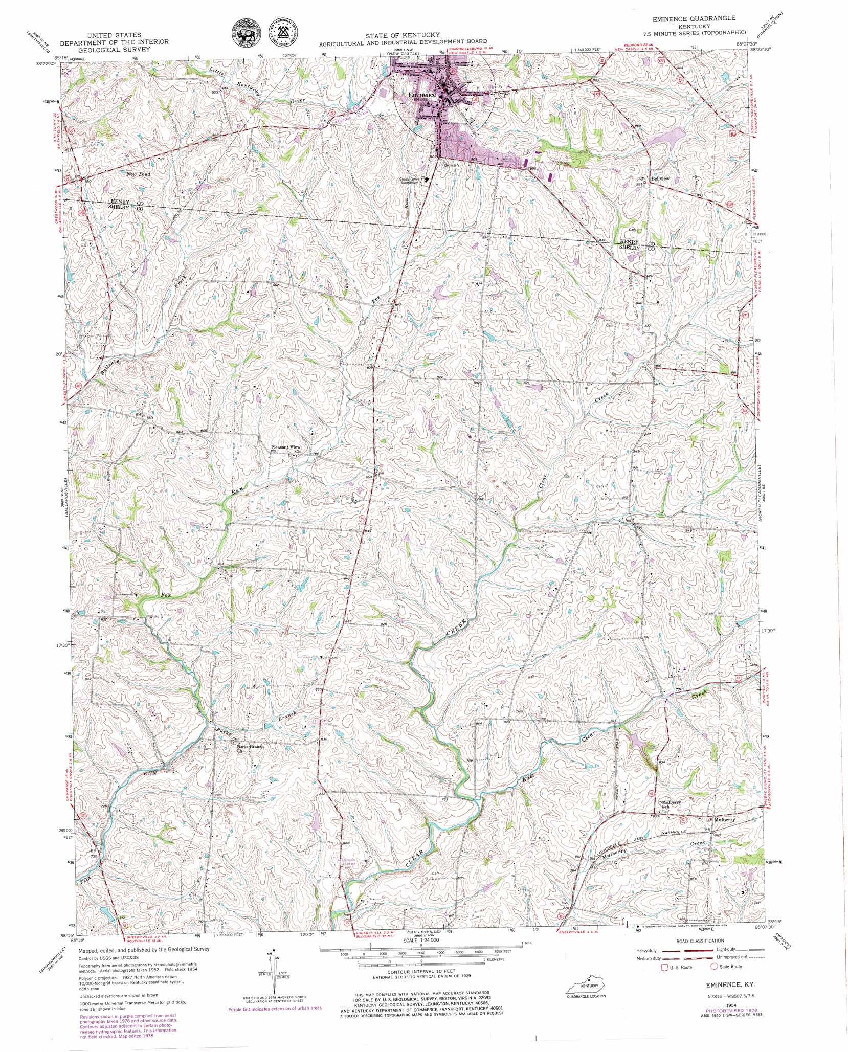
Eminence Topo Map Kentucky
To zoom in, hover over the map of Eminence
USGS Topo Quad 38085c2 - 1:24,000 scale
| Topo Map Name: | Eminence |
| USGS Topo Quad ID: | 38085c2 |
| Print Size: | ca. 21 1/4" wide x 27" high |
| Southeast Coordinates: | 38.25° N latitude / 85.125° W longitude |
| Map Center Coordinates: | 38.3125° N latitude / 85.1875° W longitude |
| U.S. State: | KY |
| Filename: | o38085c2.jpg |
| Download Map JPG Image: | Eminence topo map 1:24,000 scale |
| Map Type: | Topographic |
| Topo Series: | 7.5´ |
| Map Scale: | 1:24,000 |
| Source of Map Images: | United States Geological Survey (USGS) |
| Alternate Map Versions: |
Eminence KY 1954, updated 1955 Download PDF Buy paper map Eminence KY 1954, updated 1976 Download PDF Buy paper map Eminence KY 1954, updated 1979 Download PDF Buy paper map Eminence KY 2010 Download PDF Buy paper map Eminence KY 2013 Download PDF Buy paper map Eminence KY 2016 Download PDF Buy paper map |
1:24,000 Topo Quads surrounding Eminence
Bethlehem |
Bedford |
Campbellsburg |
Worthville |
New Liberty |
La Grange |
Smithfield |
New Castle |
Franklinton |
Gratz |
Crestwood |
Ballardsville |
Eminence |
North Pleasureville |
Polsgrove |
Fisherville |
Simpsonville |
Shelbyville |
Waddy |
Frankfort West |
Waterford |
Taylorsville |
Mount Eden |
Glensboro |
Lawrenceburg |
> Back to 38085a1 at 1:100,000 scale
> Back to 38084a1 at 1:250,000 scale
> Back to U.S. Topo Maps home
Eminence topo map: Gazetteer
Eminence: Airports
Shelby Airport elevation 248m 813′Eminence: Lakes
New Pond elevation 262m 859′Eminence: Populated Places
Bellview elevation 265m 869′Eminence elevation 285m 935′
Mulberry elevation 258m 846′
Eminence: Post Offices
Bayard Post Office (historical) elevation 256m 839′Hill Spring Post Office (historical) elevation 265m 869′
Nugent Post Office (historical) elevation 237m 777′
Eminence: Reservoirs
Todds Pond elevation 238m 780′Eminence: Springs
Wall Spring (historical) elevation 235m 770′Eminence: Streams
Burks Branch elevation 225m 738′East Clear Creek elevation 224m 734′
Eminence digital topo map on disk
Buy this Eminence topo map showing relief, roads, GPS coordinates and other geographical features, as a high-resolution digital map file on DVD: