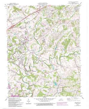
Crestwood Topo Map Kentucky
To zoom in, hover over the map of Crestwood
USGS Topo Quad 38085c4 - 1:24,000 scale
| Topo Map Name: | Crestwood |
| USGS Topo Quad ID: | 38085c4 |
| Print Size: | ca. 21 1/4" wide x 27" high |
| Southeast Coordinates: | 38.25° N latitude / 85.375° W longitude |
| Map Center Coordinates: | 38.3125° N latitude / 85.4375° W longitude |
| U.S. State: | KY |
| Filename: | o38085c4.jpg |
| Download Map JPG Image: | Crestwood topo map 1:24,000 scale |
| Map Type: | Topographic |
| Topo Series: | 7.5´ |
| Map Scale: | 1:24,000 |
| Source of Map Images: | United States Geological Survey (USGS) |
| Alternate Map Versions: |
Crestwood KY 1951 Download PDF Buy paper map Crestwood KY 1960, updated 1961 Download PDF Buy paper map Crestwood KY 1960, updated 1969 Download PDF Buy paper map Crestwood KY 1969, updated 1971 Download PDF Buy paper map Crestwood KY 1981, updated 1982 Download PDF Buy paper map Crestwood KY 1981, updated 1994 Download PDF Buy paper map Crestwood KY 2010 Download PDF Buy paper map Crestwood KY 2013 Download PDF Buy paper map Crestwood KY 2016 Download PDF Buy paper map |
1:24,000 Topo Quads surrounding Crestwood
> Back to 38085a1 at 1:100,000 scale
> Back to 38084a1 at 1:250,000 scale
> Back to U.S. Topo Maps home
Crestwood topo map: Gazetteer
Crestwood: Airports
Timmons Field elevation 208m 682′Woodledge Farm Airport elevation 208m 682′
Crestwood: Parks
Long Run Park elevation 216m 708′Crestwood: Populated Places
Avoca elevation 215m 705′Beckley elevation 187m 613′
Brownsboro elevation 218m 715′
Centerfield elevation 250m 820′
Crestwood elevation 239m 784′
Flat Rock (historical) elevation 229m 751′
Floydsburg elevation 220m 721′
Glenarm elevation 247m 810′
Park Lake elevation 229m 751′
Pewee Valley elevation 238m 780′
Rollington elevation 225m 738′
Crestwood: Post Offices
Buckner Post Office elevation 248m 813′Crestwood Post Office elevation 230m 754′
Pewee Valley Post Office elevation 239m 784′
Crestwood: Streams
Ashers Run elevation 189m 620′Currys Fork elevation 187m 613′
Dalton Run elevation 192m 629′
Junkins Run elevation 197m 646′
Lang Run elevation 195m 639′
North Fork Currys Fork elevation 204m 669′
South Fork Currys Fork elevation 205m 672′
Tater Run elevation 192m 629′
Crestwood digital topo map on disk
Buy this Crestwood topo map showing relief, roads, GPS coordinates and other geographical features, as a high-resolution digital map file on DVD:


