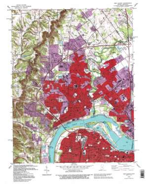
New Albany Topo Map Indiana
To zoom in, hover over the map of New Albany
USGS Topo Quad 38085c7 - 1:24,000 scale
| Topo Map Name: | New Albany |
| USGS Topo Quad ID: | 38085c7 |
| Print Size: | ca. 21 1/4" wide x 27" high |
| Southeast Coordinates: | 38.25° N latitude / 85.75° W longitude |
| Map Center Coordinates: | 38.3125° N latitude / 85.8125° W longitude |
| U.S. States: | IN, KY |
| Filename: | o38085c7.jpg |
| Download Map JPG Image: | New Albany topo map 1:24,000 scale |
| Map Type: | Topographic |
| Topo Series: | 7.5´ |
| Map Scale: | 1:24,000 |
| Source of Map Images: | United States Geological Survey (USGS) |
| Alternate Map Versions: |
New Albany IN 1939 Download PDF Buy paper map New Albany IN 1946 Download PDF Buy paper map New Albany IN 1950, updated 1955 Download PDF Buy paper map New Albany IN 1951 Download PDF Buy paper map New Albany IN 1955, updated 1956 Download PDF Buy paper map New Albany IN 1960, updated 1962 Download PDF Buy paper map New Albany IN 1965, updated 1966 Download PDF Buy paper map New Albany IN 1965, updated 1972 Download PDF Buy paper map New Albany IN 1982, updated 1982 Download PDF Buy paper map New Albany IN 1982, updated 1987 Download PDF Buy paper map New Albany IN 1992, updated 1995 Download PDF Buy paper map New Albany IN 1992, updated 1995 Download PDF Buy paper map New Albany IN 2010 Download PDF Buy paper map New Albany IN 2013 Download PDF Buy paper map New Albany IN 2016 Download PDF Buy paper map |
1:24,000 Topo Quads surrounding New Albany
> Back to 38085a1 at 1:100,000 scale
> Back to 38084a1 at 1:250,000 scale
> Back to U.S. Topo Maps home
New Albany topo map: Gazetteer
New Albany: Airports
Haps Airport elevation 142m 465′Jewish Hospital Heliport elevation 141m 462′
New Albany: Basins
Carters Hole elevation 130m 426′New Albany: Bridges
George Rogers Clark Memorial Bridge elevation 128m 419′Sherman Minton Bridge elevation 116m 380′
Sherman Minton Bridge elevation 116m 380′
New Albany: Canals
Louisville and Portland Canal elevation 128m 419′New Albany: Crossings
Interchange 1 elevation 142m 465′Interchange 3 elevation 143m 469′
Interchange 4 elevation 134m 439′
New Albany: Dams
Floyds Knobs Water Company Dam elevation 260m 853′McAlpine Dam elevation 119m 390′
McAlpine Locks elevation 130m 426′
New Albany: Falls
Falls of the Ohio elevation 136m 446′Falls of the Ohio elevation 116m 380′
New Albany: Islands
Sand Island elevation 122m 400′Shippingport Island elevation 134m 439′
New Albany: Lakes
Bills Lakes elevation 166m 544′New Albany: Parks
Anderson Park elevation 134m 439′Atlantis Water Park elevation 131m 429′
Baxter Park elevation 141m 462′
Beecher Playground elevation 140m 459′
Bicknell Park Playground elevation 134m 439′
Binford Park elevation 134m 439′
Boone Square Park elevation 140m 459′
Colgate Park elevation 134m 439′
Elliott Square Playground elevation 138m 452′
Falling Run Park elevation 134m 439′
Falls of the Ohio State Park elevation 129m 423′
Fontaine Ferry Park elevation 140m 459′
Lannan Memorial Park elevation 141m 462′
Lapping Memorial Park elevation 141m 462′
Lawrence Park elevation 140m 459′
Portland Park elevation 140m 459′
Shawnee Park elevation 128m 419′
Taylor Park elevation 134m 439′
W C Culbertson Mansion elevation 138m 452′
Westonia Playground elevation 138m 452′
New Albany: Populated Places
Blackiston Mill elevation 136m 446′Blackiston Village elevation 135m 442′
Blooms Eddy (historical) elevation 129m 423′
Capperas Banks (historical) elevation 144m 472′
Clarksville elevation 139m 456′
Floyds Knobs elevation 235m 770′
Graysville elevation 146m 479′
Louisville elevation 142m 465′
New Albany elevation 137m 449′
Portland elevation 135m 442′
Saint Marys elevation 252m 826′
Shawneeland elevation 134m 439′
Silver Hills elevation 188m 616′
New Albany: Post Offices
Galleria Post Office elevation 142m 465′New Albany Post Office elevation 137m 449′
New Albany: Streams
Arrow Run elevation 244m 800′Atkins Run elevation 253m 830′
Bald Knob Creek elevation 134m 439′
Blackiston Run elevation 128m 419′
Bow Run elevation 241m 790′
Cane Run elevation 118m 387′
Carters Run elevation 145m 475′
Chapel Branch elevation 136m 446′
Church Run elevation 247m 810′
Clear Fork elevation 137m 449′
Coryden Run elevation 135m 442′
County Run elevation 136m 446′
Crooked Run elevation 240m 787′
Cross Branch elevation 250m 820′
Cross Brook elevation 250m 820′
Fall Run elevation 116m 380′
Falling Run elevation 131m 429′
Flat Run elevation 151m 495′
Floyds Creek elevation 244m 800′
Fork Run elevation 146m 479′
Friendship Run elevation 142m 465′
Grace Run elevation 128m 419′
Green Run elevation 137m 449′
Hill Brook elevation 151m 495′
Jacobs Creek elevation 130m 426′
Jay Run elevation 143m 469′
Lamb Run elevation 250m 820′
Land Run elevation 128m 419′
Lewis Branch elevation 137m 449′
Lost Knob Brook elevation 142m 465′
Middle Creek elevation 130m 426′
Mill Creek elevation 116m 380′
Plum Run elevation 129m 423′
Rail Run elevation 143m 469′
Saint Marys Run elevation 247m 810′
Silver Creek elevation 116m 380′
Silvercrest Run elevation 132m 433′
Slate Run elevation 130m 426′
State Run elevation 130m 426′
Tabor Run elevation 143m 469′
Town Run elevation 125m 410′
Trinity Run elevation 136m 446′
Uphill Run elevation 129m 423′
Vincennes Run elevation 131m 429′
War Run elevation 253m 830′
New Albany: Summits
Bald Knob elevation 251m 823′Lost Knob elevation 263m 862′
Pine Hill elevation 233m 764′
Spickert Knob elevation 289m 948′
New Albany: Valleys
Brave Hollow elevation 244m 800′Bull Hollow elevation 264m 866′
Creek Hollow elevation 252m 826′
Duck Hollow elevation 264m 866′
Horse Hollow elevation 255m 836′
Pieiss Hollow elevation 148m 485′
Road Hollow elevation 166m 544′
South Hollow elevation 134m 439′
Squaw Hollow elevation 258m 846′
New Albany digital topo map on disk
Buy this New Albany topo map showing relief, roads, GPS coordinates and other geographical features, as a high-resolution digital map file on DVD:


