New Washington Topo Map Indiana
To zoom in, hover over the map of New Washington
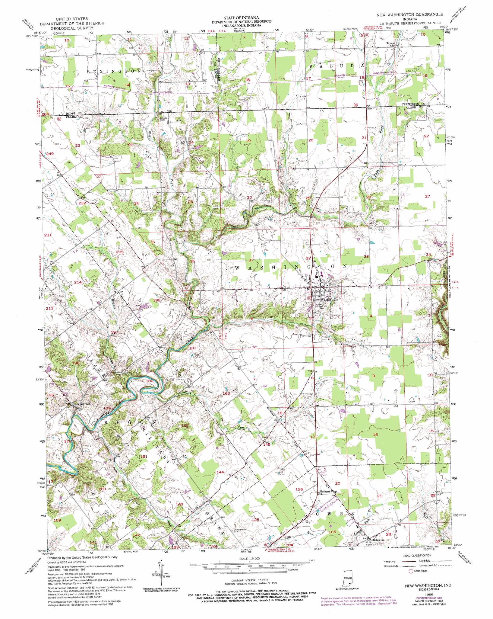
USGS Topo Quad 38085e5 - 1:24,000 scale
| Topo Map Name: | New Washington |
| USGS Topo Quad ID: | 38085e5 |
| Print Size: | ca. 21 1/4" wide x 27" high |
| Southeast Coordinates: | 38.5° N latitude / 85.5° W longitude |
| Map Center Coordinates: | 38.5625° N latitude / 85.5625° W longitude |
| U.S. State: | IN |
| Filename: | o38085e5.jpg |
| Download Map JPG Image: | New Washington topo map 1:24,000 scale |
| Map Type: | Topographic |
| Topo Series: | 7.5´ |
| Map Scale: | 1:24,000 |
| Source of Map Images: | United States Geological Survey (USGS) |
| Alternate Map Versions: |
New Washington IN 1956, updated 1957 Download PDF Buy paper map New Washington IN 1956, updated 1973 Download PDF Buy paper map New Washington IN 1956, updated 1981 Download PDF Buy paper map New Washington IN 1956, updated 1993 Download PDF Buy paper map New Washington IN 2010 Download PDF Buy paper map New Washington IN 2013 Download PDF Buy paper map New Washington IN 2016 Download PDF Buy paper map |
1:24,000 Topo Quads surrounding New Washington
Crothersville |
Deputy |
Volga |
Clifty Falls |
Canaan |
Scottsburg |
Blocher |
Kent |
Madison West |
Madison East |
Henryville |
Otisco |
New Washington |
Bethlehem |
Bedford |
Speed |
Charlestown |
Owen |
La Grange |
Smithfield |
New Albany |
Jeffersonville |
Anchorage |
Crestwood |
Ballardsville |
> Back to 38085e1 at 1:100,000 scale
> Back to 38084a1 at 1:250,000 scale
> Back to U.S. Topo Maps home
New Washington topo map: Gazetteer
New Washington: Populated Places
Hibernia elevation 220m 721′New Market elevation 199m 652′
New Washington elevation 219m 718′
New Washington: Post Offices
Polk Run Post Office (historical) elevation 202m 662′New Washington: Streams
Camp Creek elevation 183m 600′East Fork Fourteenmile Creek elevation 184m 603′
Flag Run elevation 178m 583′
Polk Run elevation 176m 577′
Rogers Run elevation 176m 577′
West Fork Fourteenmile Creek elevation 184m 603′
New Washington digital topo map on disk
Buy this New Washington topo map showing relief, roads, GPS coordinates and other geographical features, as a high-resolution digital map file on DVD: