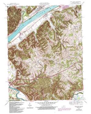
Vevay South Topo Map Kentucky
To zoom in, hover over the map of Vevay South
USGS Topo Quad 38085f1 - 1:24,000 scale
| Topo Map Name: | Vevay South |
| USGS Topo Quad ID: | 38085f1 |
| Print Size: | ca. 21 1/4" wide x 27" high |
| Southeast Coordinates: | 38.625° N latitude / 85° W longitude |
| Map Center Coordinates: | 38.6875° N latitude / 85.0625° W longitude |
| U.S. States: | KY, IN |
| Filename: | o38085f1.jpg |
| Download Map JPG Image: | Vevay South topo map 1:24,000 scale |
| Map Type: | Topographic |
| Topo Series: | 7.5´ |
| Map Scale: | 1:24,000 |
| Source of Map Images: | United States Geological Survey (USGS) |
| Alternate Map Versions: |
Vevay South IN 1943 Download PDF Buy paper map Vevay South IN 1952, updated 1954 Download PDF Buy paper map Vevay South IN 1952, updated 1966 Download PDF Buy paper map Vevay South IN 1967, updated 1969 Download PDF Buy paper map Vevay South IN 1967, updated 1981 Download PDF Buy paper map Vevay South IN 1967, updated 1994 Download PDF Buy paper map Vevay South IN 2010 Download PDF Buy paper map Vevay South IN 2013 Download PDF Buy paper map Vevay South IN 2016 Download PDF Buy paper map |
1:24,000 Topo Quads surrounding Vevay South
> Back to 38085e1 at 1:100,000 scale
> Back to 38084a1 at 1:250,000 scale
> Back to U.S. Topo Maps home
Vevay South topo map: Gazetteer
Vevay South: Bars
Craig Bar elevation 128m 419′Vevay South: Lakes
Snell Lake elevation 233m 764′Vevay South: Populated Places
Easterday elevation 208m 682′Ghent elevation 148m 485′
Langstaff elevation 141m 462′
Rockville (historical) elevation 173m 567′
Vevay elevation 147m 482′
Vevay South: Post Offices
Eagle Station Post Office (historical) elevation 146m 479′Easterday Post Office (historical) elevation 206m 675′
Grass Hills Post Office (historical) elevation 256m 839′
Tandy Post Office (historical) elevation 173m 567′
Vevay South: Streams
Black Rock Creek elevation 128m 419′Fourmile Creek elevation 133m 436′
Goose Creek elevation 130m 426′
Indian Creek elevation 129m 423′
Lees Creek elevation 137m 449′
McCools Creek elevation 131m 429′
Mennets Run elevation 128m 419′
Mill Creek elevation 131m 429′
South Fork McCools Creek elevation 137m 449′
Whites Run elevation 131m 429′
Vevay South: Summits
Potato Bug Hill elevation 277m 908′Vevay South: Valleys
Whiskey Hollow elevation 142m 465′Vevay South digital topo map on disk
Buy this Vevay South topo map showing relief, roads, GPS coordinates and other geographical features, as a high-resolution digital map file on DVD:


