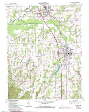
Scottsburg Topo Map Indiana
To zoom in, hover over the map of Scottsburg
USGS Topo Quad 38085f7 - 1:24,000 scale
| Topo Map Name: | Scottsburg |
| USGS Topo Quad ID: | 38085f7 |
| Print Size: | ca. 21 1/4" wide x 27" high |
| Southeast Coordinates: | 38.625° N latitude / 85.75° W longitude |
| Map Center Coordinates: | 38.6875° N latitude / 85.8125° W longitude |
| U.S. State: | IN |
| Filename: | o38085f7.jpg |
| Download Map JPG Image: | Scottsburg topo map 1:24,000 scale |
| Map Type: | Topographic |
| Topo Series: | 7.5´ |
| Map Scale: | 1:24,000 |
| Source of Map Images: | United States Geological Survey (USGS) |
| Alternate Map Versions: |
Scottsburg IN 1947 Download PDF Buy paper map Scottsburg IN 1960, updated 1961 Download PDF Buy paper map Scottsburg IN 1960, updated 1975 Download PDF Buy paper map Scottsburg IN 1960, updated 1981 Download PDF Buy paper map Scottsburg IN 1960, updated 1988 Download PDF Buy paper map Scottsburg IN 1960, updated 1994 Download PDF Buy paper map Scottsburg IN 2010 Download PDF Buy paper map Scottsburg IN 2013 Download PDF Buy paper map Scottsburg IN 2016 Download PDF Buy paper map |
1:24,000 Topo Quads surrounding Scottsburg
> Back to 38085e1 at 1:100,000 scale
> Back to 38084a1 at 1:250,000 scale
> Back to U.S. Topo Maps home
Scottsburg topo map: Gazetteer
Scottsburg: Airports
Scottsburg Airport elevation 184m 603′Scottsburg: Canals
Ox Ditch elevation 159m 521′Stink Ditch elevation 160m 524′
Scottsburg: Dams
David Garriott Lake Dam elevation 183m 600′Don Reid Lake Dam elevation 174m 570′
Forest Helton Lake Dam elevation 174m 570′
Hamilton and Ridlen Lake Dam elevation 169m 554′
Hosea Lake Dam elevation 172m 564′
Marshall King Lake Dam elevation 171m 561′
Scottsburg Water Works Dam elevation 176m 577′
Scottsburg: Populated Places
Leota elevation 185m 606′Marshfield elevation 164m 538′
Scottsburg elevation 172m 564′
Vienna elevation 174m 570′
Scottsburg: Reservoirs
David Garriott Lake elevation 183m 600′Don Reid Lake elevation 174m 570′
Forrest Helton Lake elevation 174m 570′
Hamilton and Ridlen Lake elevation 169m 554′
Hosea Lake elevation 172m 564′
Iola Lake elevation 167m 547′
Marshall King Lake elevation 171m 561′
Scottsburg Reservoir elevation 176m 577′
Scottsburg: Streams
Baby Run elevation 177m 580′Bee Branch elevation 180m 590′
Big Ox Creek elevation 158m 518′
Bird Run elevation 165m 541′
Brown Run elevation 179m 587′
Calf Creek elevation 164m 538′
Carlisle Run elevation 165m 541′
Clark Run elevation 181m 593′
Cold Run elevation 164m 538′
Coonie Creek elevation 164m 538′
Cub Branch elevation 185m 606′
Dog Run elevation 167m 547′
Elm Branch elevation 167m 547′
Estil Run elevation 167m 547′
Fire Run elevation 163m 534′
Five Branch elevation 158m 518′
Flat Creek elevation 162m 531′
Forest Run elevation 186m 610′
Honey Run elevation 161m 528′
Hope Branch elevation 168m 551′
Hopewell Drain elevation 167m 547′
Hutto Creek elevation 161m 528′
Iola Run elevation 161m 528′
Jabber Run elevation 174m 570′
Little Joe Creek elevation 162m 531′
Little Ox Creek elevation 171m 561′
Maple Run elevation 166m 544′
Nest Run elevation 171m 561′
Old Run elevation 161m 528′
Pigeon Roost Creek elevation 164m 538′
Plain Drain elevation 158m 518′
Plow Drain elevation 161m 528′
Providence Branch elevation 167m 547′
Providence Run elevation 163m 534′
Rail Run elevation 171m 561′
Roosting Run elevation 174m 570′
Running Drain elevation 161m 528′
Scottsburg Drain elevation 164m 538′
Small Brook elevation 164m 538′
Steep Run elevation 164m 538′
Sting Brook elevation 170m 557′
Stop Run elevation 161m 528′
Stucker Fork elevation 158m 518′
Sycamore Run elevation 171m 561′
Toast Brook elevation 164m 538′
Town Run elevation 177m 580′
Tree Creek elevation 167m 547′
Vienna Branch elevation 171m 561′
Zion Run elevation 166m 544′
Scottsburg: Valleys
Buzz Gully elevation 167m 547′Puppy Hollow elevation 173m 567′
Scottsburg digital topo map on disk
Buy this Scottsburg topo map showing relief, roads, GPS coordinates and other geographical features, as a high-resolution digital map file on DVD:


