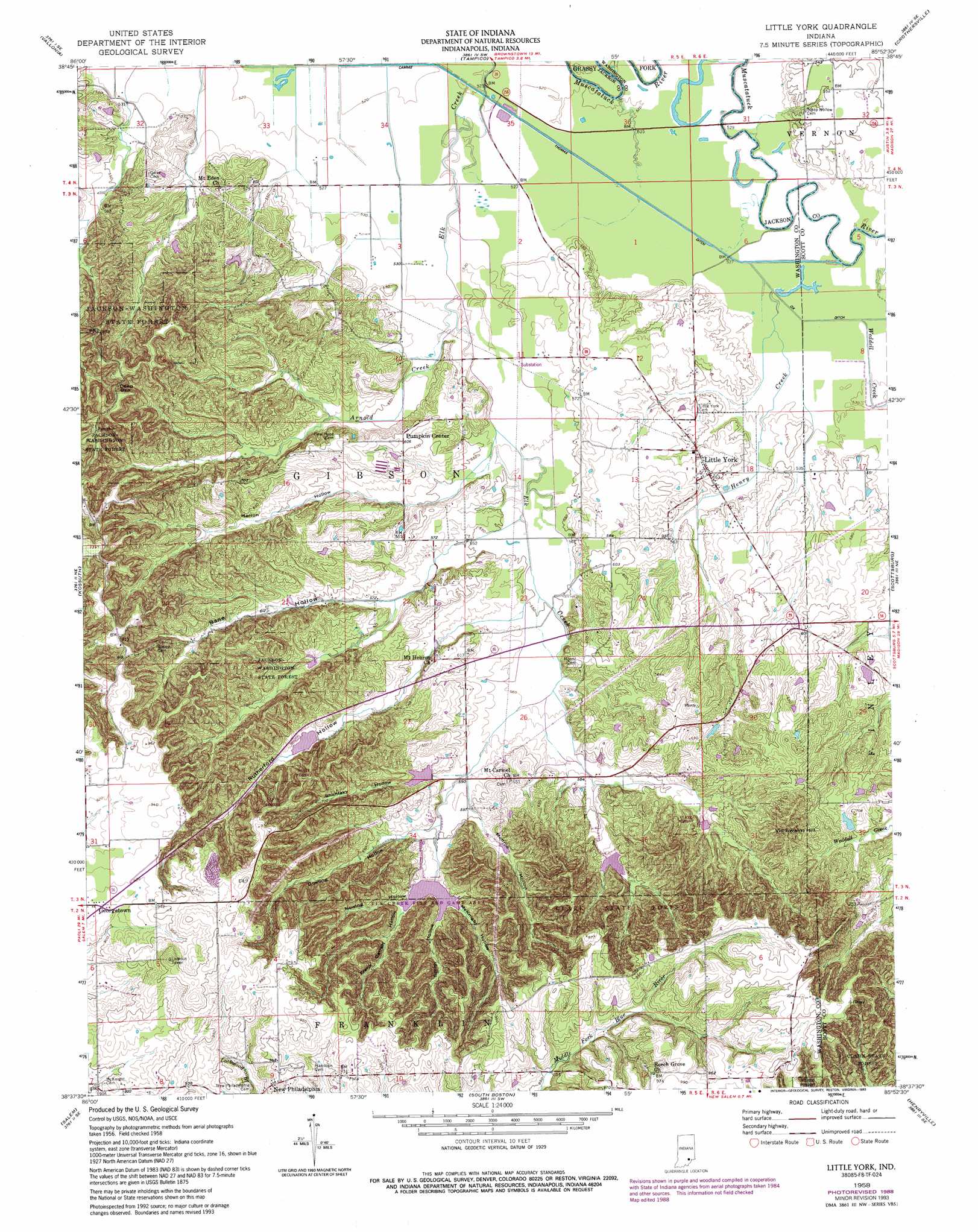
Little York Topo Map Indiana
To zoom in, hover over the map of Little York
USGS Topo Quad 38085f8 - 1:24,000 scale
| Topo Map Name: | Little York |
| USGS Topo Quad ID: | 38085f8 |
| Print Size: | ca. 21 1/4" wide x 27" high |
| Southeast Coordinates: | 38.625° N latitude / 85.875° W longitude |
| Map Center Coordinates: | 38.6875° N latitude / 85.9375° W longitude |
| U.S. State: | IN |
| Filename: | o38085f8.jpg |
| Download Map JPG Image: | Little York topo map 1:24,000 scale |
| Map Type: | Topographic |
| Topo Series: | 7.5´ |
| Map Scale: | 1:24,000 |
| Source of Map Images: | United States Geological Survey (USGS) |
| Alternate Map Versions: |
Little York IN 1958, updated 1959 Download PDF Buy paper map Little York IN 1958, updated 1969 Download PDF Buy paper map Little York IN 1958, updated 1981 Download PDF Buy paper map Little York IN 1958, updated 1988 Download PDF Buy paper map Little York IN 1958, updated 1993 Download PDF Buy paper map Little York IN 1958, updated 1993 Download PDF Buy paper map Little York IN 2010 Download PDF Buy paper map Little York IN 2013 Download PDF Buy paper map Little York IN 2016 Download PDF Buy paper map |
1:24,000 Topo Quads surrounding Little York
Kurtz |
Brownstown |
Seymour |
Chestnut Ridge |
Hayden |
Medora |
Vallonia |
Tampico |
Crothersville |
Deputy |
Smedley |
Kossuth |
Little York |
Scottsburg |
Blocher |
Becks Mill |
Salem |
South Boston |
Henryville |
Otisco |
Fredericksburg |
Palmyra |
Borden |
Speed |
Charlestown |
> Back to 38085e1 at 1:100,000 scale
> Back to 38084a1 at 1:250,000 scale
> Back to U.S. Topo Maps home
Little York topo map: Gazetteer
Little York: Canals
Cammie Thomas Ditch elevation 158m 518′Little York: Dams
Elk Creek Structure Number 3 elevation 186m 610′Elk Creek Structure Number 7 elevation 187m 613′
Elk Creek Structure Number 8 elevation 189m 620′
Little York: Parks
Elk Creek Fish and Game Area elevation 195m 639′Elk Creek Public Fishing Area elevation 241m 790′
Little York: Populated Places
Georgetown elevation 282m 925′Gooseport elevation 174m 570′
Little York elevation 167m 547′
New Philadelphia elevation 287m 941′
Pumpkin Center elevation 185m 606′
Little York: Streams
Elk Creek elevation 158m 518′Weddell Creek elevation 161m 528′
Little York: Summits
Vic Swaim Hill elevation 260m 853′Little York digital topo map on disk
Buy this Little York topo map showing relief, roads, GPS coordinates and other geographical features, as a high-resolution digital map file on DVD: