Clifty Falls Topo Map Indiana
To zoom in, hover over the map of Clifty Falls
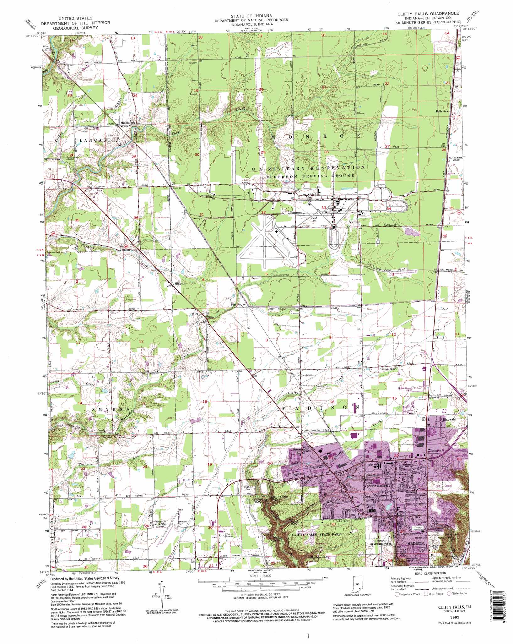
USGS Topo Quad 38085g4 - 1:24,000 scale
| Topo Map Name: | Clifty Falls |
| USGS Topo Quad ID: | 38085g4 |
| Print Size: | ca. 21 1/4" wide x 27" high |
| Southeast Coordinates: | 38.75° N latitude / 85.375° W longitude |
| Map Center Coordinates: | 38.8125° N latitude / 85.4375° W longitude |
| U.S. State: | IN |
| Filename: | o38085g4.jpg |
| Download Map JPG Image: | Clifty Falls topo map 1:24,000 scale |
| Map Type: | Topographic |
| Topo Series: | 7.5´ |
| Map Scale: | 1:24,000 |
| Source of Map Images: | United States Geological Survey (USGS) |
| Alternate Map Versions: |
Clifty Falls IN 1956, updated 1957 Download PDF Buy paper map Clifty Falls IN 1964, updated 1965 Download PDF Buy paper map Clifty Falls IN 1964, updated 1981 Download PDF Buy paper map Clifty Falls IN 1964, updated 1990 Download PDF Buy paper map Clifty Falls IN 1992, updated 1995 Download PDF Buy paper map Clifty Falls IN 2010 Download PDF Buy paper map Clifty Falls IN 2013 Download PDF Buy paper map Clifty Falls IN 2016 Download PDF Buy paper map |
1:24,000 Topo Quads surrounding Clifty Falls
North Vernon |
Butlerville |
Holton |
Versailles |
Milan |
Hayden |
Vernon |
San Jacinto |
Rexville |
Cross Plains |
Deputy |
Volga |
Clifty Falls |
Canaan |
Bennington |
Blocher |
Kent |
Madison West |
Madison East |
Carrollton |
Otisco |
New Washington |
Bethlehem |
Bedford |
Campbellsburg |
> Back to 38085e1 at 1:100,000 scale
> Back to 38084a1 at 1:250,000 scale
> Back to U.S. Topo Maps home
Clifty Falls topo map: Gazetteer
Clifty Falls: Airports
Madison Municipal Airport elevation 247m 810′Clifty Falls: Cliffs
Hanging Rock elevation 247m 810′Clifty Falls: Falls
Clifty Falls elevation 229m 751′Hoffman Falls elevation 212m 695′
Little Clifty Falls elevation 217m 711′
Tunnel Falls elevation 210m 688′
Wallace Falls elevation 174m 570′
Clifty Falls: Parks
Clifty Falls State Park elevation 257m 843′Clifty Falls: Populated Places
Belleview elevation 271m 889′Calloway Station (historical) elevation 252m 826′
Middlefork elevation 236m 774′
Midway elevation 251m 823′
North Madison elevation 274m 898′
Ringwald elevation 279m 915′
Smyrna elevation 226m 741′
Wirt elevation 247m 810′
Wirt Station elevation 256m 839′
Clifty Falls: Post Offices
Mud Luck Post Office (historical) elevation 274m 898′Stony Point Post Office (historical) elevation 273m 895′
Clifty Falls: Streams
Deans Branch elevation 169m 554′Little Clifty Creek elevation 181m 593′
Clifty Falls digital topo map on disk
Buy this Clifty Falls topo map showing relief, roads, GPS coordinates and other geographical features, as a high-resolution digital map file on DVD: