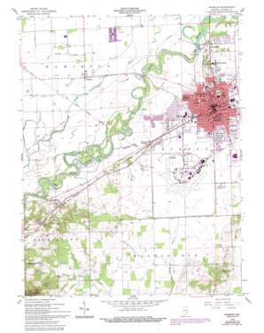
Seymour Topo Map Indiana
To zoom in, hover over the map of Seymour
USGS Topo Quad 38085h8 - 1:24,000 scale
| Topo Map Name: | Seymour |
| USGS Topo Quad ID: | 38085h8 |
| Print Size: | ca. 21 1/4" wide x 27" high |
| Southeast Coordinates: | 38.875° N latitude / 85.875° W longitude |
| Map Center Coordinates: | 38.9375° N latitude / 85.9375° W longitude |
| U.S. State: | IN |
| Filename: | o38085h8.jpg |
| Download Map JPG Image: | Seymour topo map 1:24,000 scale |
| Map Type: | Topographic |
| Topo Series: | 7.5´ |
| Map Scale: | 1:24,000 |
| Source of Map Images: | United States Geological Survey (USGS) |
| Alternate Map Versions: |
Seymour IN 1958, updated 1960 Download PDF Buy paper map Seymour IN 1958, updated 1976 Download PDF Buy paper map Seymour IN 1958, updated 1981 Download PDF Buy paper map Seymour IN 1958, updated 1988 Download PDF Buy paper map Seymour IN 1958, updated 1994 Download PDF Buy paper map Seymour IN 2010 Download PDF Buy paper map Seymour IN 2013 Download PDF Buy paper map Seymour IN 2016 Download PDF Buy paper map |
1:24,000 Topo Quads surrounding Seymour
> Back to 38085e1 at 1:100,000 scale
> Back to 38084a1 at 1:250,000 scale
> Back to U.S. Topo Maps home
Seymour topo map: Gazetteer
Seymour: Airports
Freeman Municipal Airport elevation 175m 574′Seymour: Canals
Von Fange Ditch elevation 172m 564′Seymour: Parks
Gaiser Park elevation 178m 583′Shields Park elevation 186m 610′
Seymour: Populated Places
Cortland elevation 171m 561′Hangman Crossing elevation 172m 564′
New Elizabethtown elevation 178m 583′
Rockford elevation 184m 603′
Seymour elevation 184m 603′
Sunset Parkway elevation 176m 577′
Seymour: Streams
Heddy Run elevation 165m 541′Thompson Slough elevation 168m 551′
Seymour: Summits
Pinnacle elevation 289m 948′Seymour digital topo map on disk
Buy this Seymour topo map showing relief, roads, GPS coordinates and other geographical features, as a high-resolution digital map file on DVD:


