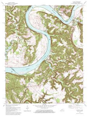
Alton Topo Map Kentucky
To zoom in, hover over the map of Alton
USGS Topo Quad 38086a4 - 1:24,000 scale
| Topo Map Name: | Alton |
| USGS Topo Quad ID: | 38086a4 |
| Print Size: | ca. 21 1/4" wide x 27" high |
| Southeast Coordinates: | 38° N latitude / 86.375° W longitude |
| Map Center Coordinates: | 38.0625° N latitude / 86.4375° W longitude |
| U.S. States: | KY, IN |
| Filename: | o38086a4.jpg |
| Download Map JPG Image: | Alton topo map 1:24,000 scale |
| Map Type: | Topographic |
| Topo Series: | 7.5´ |
| Map Scale: | 1:24,000 |
| Source of Map Images: | United States Geological Survey (USGS) |
| Alternate Map Versions: |
Alton IN 1950, updated 1962 Download PDF Buy paper map Alton IN 1951 Download PDF Buy paper map Alton IN 1951, updated 1968 Download PDF Buy paper map Alton IN 1970, updated 1972 Download PDF Buy paper map Alton IN 1993, updated 1998 Download PDF Buy paper map Alton IN 2010 Download PDF Buy paper map Alton IN 2013 Download PDF Buy paper map Alton IN 2016 Download PDF Buy paper map |
| FStopo: | US Forest Service topo Alton is available: Download FStopo PDF Download FStopo TIF |
1:24,000 Topo Quads surrounding Alton
> Back to 38086a1 at 1:100,000 scale
> Back to 38086a1 at 1:250,000 scale
> Back to U.S. Topo Maps home
Alton topo map: Gazetteer
Alton: Basins
Jarbo Sinks elevation 145m 475′Alton: Bends
Little Bend elevation 173m 567′Willets Bottom elevation 135m 442′
Alton: Capes
Bulls Point elevation 132m 433′Alton: Islands
Flint Island elevation 123m 403′Alton: Populated Places
Alton elevation 130m 426′Concordia elevation 137m 449′
Dexter elevation 129m 423′
Magnet elevation 152m 498′
Mooleyville elevation 176m 577′
Rhodelia elevation 197m 646′
Roberta elevation 176m 577′
Wolf Creek elevation 129m 423′
Alton: Streams
Bear Creek elevation 120m 393′Boone Creek elevation 125m 410′
Little Blue River elevation 121m 396′
Mill Creek elevation 116m 380′
Spring Creek elevation 116m 380′
Watson Run elevation 116m 380′
Wolf Creek elevation 116m 380′
Alton: Valleys
Boone Hollow elevation 116m 380′Dark Hollow elevation 124m 406′
Alton digital topo map on disk
Buy this Alton topo map showing relief, roads, GPS coordinates and other geographical features, as a high-resolution digital map file on DVD:


