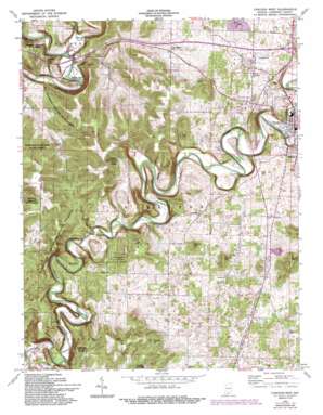
Corydon West Topo Map Indiana
To zoom in, hover over the map of Corydon West
USGS Topo Quad 38086b2 - 1:24,000 scale
| Topo Map Name: | Corydon West |
| USGS Topo Quad ID: | 38086b2 |
| Print Size: | ca. 21 1/4" wide x 27" high |
| Southeast Coordinates: | 38.125° N latitude / 86.125° W longitude |
| Map Center Coordinates: | 38.1875° N latitude / 86.1875° W longitude |
| U.S. State: | IN |
| Filename: | o38086b2.jpg |
| Download Map JPG Image: | Corydon West topo map 1:24,000 scale |
| Map Type: | Topographic |
| Topo Series: | 7.5´ |
| Map Scale: | 1:24,000 |
| Source of Map Images: | United States Geological Survey (USGS) |
| Alternate Map Versions: |
Corydon West IN 1944, updated 1955 Download PDF Buy paper map Corydon West IN 1947 Download PDF Buy paper map Corydon West IN 1962, updated 1964 Download PDF Buy paper map Corydon West IN 1962, updated 1973 Download PDF Buy paper map Corydon West IN 1962, updated 1981 Download PDF Buy paper map Corydon West IN 1962, updated 1983 Download PDF Buy paper map Corydon West IN 1962, updated 1994 Download PDF Buy paper map Corydon West IN 2010 Download PDF Buy paper map Corydon West IN 2014 Download PDF Buy paper map Corydon West IN 2016 Download PDF Buy paper map |
1:24,000 Topo Quads surrounding Corydon West
> Back to 38086a1 at 1:100,000 scale
> Back to 38086a1 at 1:250,000 scale
> Back to U.S. Topo Maps home
Corydon West topo map: Gazetteer
Corydon West: Populated Places
Dixie elevation 190m 623′White Cloud elevation 139m 456′
Corydon West: Ridges
Devils Backbone elevation 136m 446′Corydon West: Springs
Harrison Spring elevation 138m 452′Corydon West: Streams
Hickman Branch elevation 131m 429′Little Indian Creek elevation 164m 538′
Corydon West: Summits
Binkley Hill elevation 255m 836′Mathes Hill elevation 249m 816′
Pilot Knob elevation 263m 862′
Scout Mountain elevation 210m 688′
Windell Hill elevation 272m 892′
Corydon West digital topo map on disk
Buy this Corydon West topo map showing relief, roads, GPS coordinates and other geographical features, as a high-resolution digital map file on DVD:


