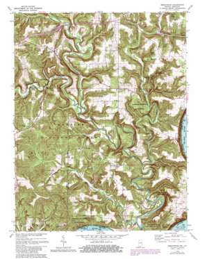
Beechwood Topo Map Indiana
To zoom in, hover over the map of Beechwood
USGS Topo Quad 38086b4 - 1:24,000 scale
| Topo Map Name: | Beechwood |
| USGS Topo Quad ID: | 38086b4 |
| Print Size: | ca. 21 1/4" wide x 27" high |
| Southeast Coordinates: | 38.125° N latitude / 86.375° W longitude |
| Map Center Coordinates: | 38.1875° N latitude / 86.4375° W longitude |
| U.S. States: | IN, KY |
| Filename: | o38086b4.jpg |
| Download Map JPG Image: | Beechwood topo map 1:24,000 scale |
| Map Type: | Topographic |
| Topo Series: | 7.5´ |
| Map Scale: | 1:24,000 |
| Source of Map Images: | United States Geological Survey (USGS) |
| Alternate Map Versions: |
Beechwood IN 1950, updated 1952 Download PDF Buy paper map Beechwood IN 1950, updated 1963 Download PDF Buy paper map Beechwood IN 1950, updated 1967 Download PDF Buy paper map Beechwood IN 1970, updated 1972 Download PDF Buy paper map Beechwood IN 1970, updated 1981 Download PDF Buy paper map Beechwood IN 1993, updated 1998 Download PDF Buy paper map Beechwood IN 2010 Download PDF Buy paper map Beechwood IN 2013 Download PDF Buy paper map Beechwood IN 2016 Download PDF Buy paper map |
| FStopo: | US Forest Service topo Beechwood is available: Download FStopo PDF Download FStopo TIF |
1:24,000 Topo Quads surrounding Beechwood
> Back to 38086a1 at 1:100,000 scale
> Back to 38086a1 at 1:250,000 scale
> Back to U.S. Topo Maps home
Beechwood topo map: Gazetteer
Beechwood: Parks
Sulphur Lake Picinic Area elevation 203m 666′Beechwood: Populated Places
Beechwood elevation 199m 652′Deuchars elevation 201m 659′
Fredonia elevation 204m 669′
Jericho elevation 192m 629′
Magnolia elevation 154m 505′
Sulphur elevation 217m 711′
Sulphur Springs elevation 129m 423′
Beechwood: Reservoirs
Oriole Lake elevation 239m 784′Beechwood: Streams
Jaby Creek elevation 146m 479′Low Gap Branch elevation 119m 390′
Mill Creek elevation 121m 396′
Stinking Fork elevation 121m 396′
Turkey Fork elevation 118m 387′
Beechwood digital topo map on disk
Buy this Beechwood topo map showing relief, roads, GPS coordinates and other geographical features, as a high-resolution digital map file on DVD:


