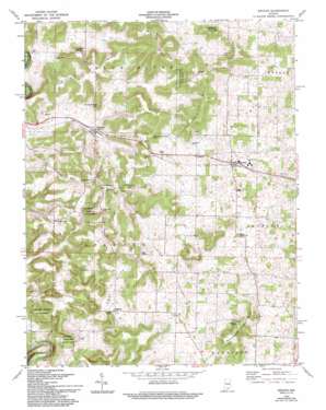
Depauw Topo Map Indiana
To zoom in, hover over the map of Depauw
USGS Topo Quad 38086c2 - 1:24,000 scale
| Topo Map Name: | Depauw |
| USGS Topo Quad ID: | 38086c2 |
| Print Size: | ca. 21 1/4" wide x 27" high |
| Southeast Coordinates: | 38.25° N latitude / 86.125° W longitude |
| Map Center Coordinates: | 38.3125° N latitude / 86.1875° W longitude |
| U.S. State: | IN |
| Filename: | o38086c2.jpg |
| Download Map JPG Image: | Depauw topo map 1:24,000 scale |
| Map Type: | Topographic |
| Topo Series: | 7.5´ |
| Map Scale: | 1:24,000 |
| Source of Map Images: | United States Geological Survey (USGS) |
| Alternate Map Versions: |
Depauw IN 1946 Download PDF Buy paper map Depauw IN 1962, updated 1963 Download PDF Buy paper map Depauw IN 1962, updated 1973 Download PDF Buy paper map Depauw IN 1962, updated 1994 Download PDF Buy paper map Depauw IN 2010 Download PDF Buy paper map Depauw IN 2013 Download PDF Buy paper map Depauw IN 2016 Download PDF Buy paper map |
1:24,000 Topo Quads surrounding Depauw
> Back to 38086a1 at 1:100,000 scale
> Back to 38086a1 at 1:250,000 scale
> Back to U.S. Topo Maps home
Depauw topo map: Gazetteer
Depauw: Airports
Glen-Hire Ranch Airport elevation 187m 613′Depauw: Bends
Devils Elbow elevation 140m 459′Depauw: Populated Places
Depauw elevation 198m 649′Fairdale elevation 218m 715′
Frenchtown elevation 266m 872′
Little Saint Louis elevation 229m 751′
Moberly elevation 185m 606′
Ramsey elevation 215m 705′
Depauw: Ridges
Byrd Ridge elevation 272m 892′Lagle Ridge elevation 292m 958′
Opossum Trial Ridge elevation 276m 905′
Orchard Ridge elevation 264m 866′
Pennington Chapel Ridge elevation 273m 895′
Depauw: Springs
Leichner Spring elevation 227m 744′Depauw: Summits
Henry Ott Hill elevation 278m 912′Marion Herthel Hill elevation 264m 866′
Schoolhouse Hill elevation 238m 780′
Seigs Hill elevation 281m 921′
Depauw: Valleys
Baker Hollow elevation 180m 590′Clover Valley elevation 199m 652′
Depauw digital topo map on disk
Buy this Depauw topo map showing relief, roads, GPS coordinates and other geographical features, as a high-resolution digital map file on DVD:


